
Places near here
Photo credits
- National Inventory of Architectural Heritage
- Mike Searle, Geograph · CC BY-SA 2.0
- Paul Cowan, Wikimedia Commons · CC BY-SA 2.0
- David Purchase, Geograph · Creative Commons Attribution-ShareAlike 2.0
- Willow, Wikimedia Commons · CC BY 2.5
- Andreas F. Borchert, Wikimedia Commons · CC BY-SA 4.0
- Enda O Flaherty, Geograph · CC BY-SA 2.0
- The original uploader was Dppowell at English Wikipedia ., Wikimedia Commons · CC BY-SA 2.5
- Rick Crowley, Wikimedia Commons · CC BY-SA 2.0
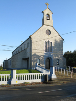 Catholic Church of Saint Margaret Mary AlacoqueChurch/chapel · 769 yd
Explorer Tom Catholic Church of Saint Margaret Mary Alacoque in Bekan is named after a saint whose name sounds like a fancy cocktail you’d order at a very serious pub. It’s an early twentieth-century build that replaced an older chapel, which just proves that people always want to upgrade their holy hangouts. The design is attributed to a Reverend White, so it’s basically a religious interior design project. I
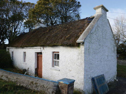 farm house1313 yd
Explorer Tom Farm house in Lisbaun West, County Mayo would tell a teenager that the 1800s were basically just a long nap with better stone. Its thatch gets a fresh coat every year like a perm. Linger, it's got stories to tell.
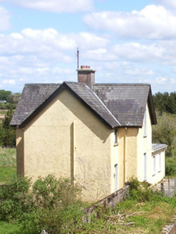 Bekan Railway StationStation master's house · 2.3 mi
Explorer Tom Bekan Railway Station in Cuilbeg is the station master’s house, which sounds like a job title from a Victorian novel. It’s part of the MGWR line development, so it’s got some railway history baked into the walls. The fabric is intact, but the replacements have changed the look a bit. Just imagine the clatter of trains passing by; it’s all in your head now.
 IndicatedHouse, fortified house · 2.3 mi
Explorer Tom House in Island is currently being judged by rabbits who think its gunloops are just fancy holes for them to hide in. They’re not wrong, actually. Get there early and have it all to yourself.
 CastleCastle, unclassified · 2.3 mi
Explorer Tom Castle on Island Lake hates when people ask if it’s haunted; it prefers ‘mysteriously absent’. It vanished so fast the locals just shrugged and built a house instead. Bring a flask of something warm and a story to swap.
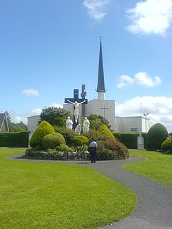 Knock ShrineHeritage attraction · 3.1 mi
Explorer Tom I'll keep my big mouth quiet for the people praying at Knock. Knock Shrine grew from an evening that the people present never forgot. On 21 August 1879, Mary Byrne and other villagers said they saw figures at the church gable while the Mayo rain came down. Their accounts describe a still scene that lasted nearly two hours, with people gathering and praying; the witnesses also said the ground around the figures stayed dry. I am not going to tell you what they saw. Mayo rain rarely asks my permission, but the witnesses' account asks for careful listening. What I can tell you is that their words were taken down by a church inquiry that autumn, and a second inquiry in 1936 returned to surviving witnesses because many early papers were thought lost. The original wall attracted so many visitors that pieces were taken away as souvenirs. Today this is a living place of pilgrimage, so enter with care for the people who have come to pray. Whatever you believe, listen to how a wet evening changed a village's place in the world.
 Grave YardGraveyard · 4.6 mi
Explorer Tom Graveyard in Aghamore would post a photo of its mossy headstones with the caption 'Living my best quiet life, #ancient'. It’s got that moody, atmospheric vibe going on that makes you feel instantly profound. Have a wander and a wonder.
 European ash16 mi
Explorer Tom European ash remembers when the builder was thinking about putting a swing here but decided against it because of the wind speed. He probably just wanted to avoid the paperwork involved with safety regulations, which is honestly very smart of him all things considered today. Tell the next person you meet it’s haunted. It might be.
 Cloigtheach (Round Tower)Round tower · 16 mi
Explorer Tom Cloigtheach (Round Tower) in Pollacorragune is standing guard like a very tired bouncer. It's got a high doorway because apparently nobody walks anymore. Ring your granny and tell her where you are before you get lost.
 KnockmaaWood · 20 mi
Explorer Tom Knockmaa is secretly dating Dolly Parton, and she only visits when the light hits just right. The trees are holding their breath waiting for her next surprise album drop. Bring curiosity, leave with a better story than mine.
 Ross Errilly FriaryHeritage attraction · 23 mi
Explorer Tom Call Ross Errilly an abbey and somebody in Galway may forgive you, but the friars would ask where you found their abbot. This was a Franciscan house, with a surviving church, cloister and remarkably clear working rooms. Find the kitchen: it had an oven and a tank for keeping fish alive. I can barely keep a loaf from burning, so fair play to their planning. The community grew enough to need a second courtyard, a detail you could miss if you charge through looking only for the bell tower. Ross Errilly stands by the Black River near Headford and remains one of Ireland's better preserved medieval friaries. Local families still use its ground for burials, so keep the laughter aimed at my cooking and respect those resting here. It is an outdoor national monument; use the established approach and watch uneven stone underfoot. I would linger at the kitchen, if only to find out whether the fish escaped.
 Inis an GhaillIsland · 27 mi
Explorer Tom Inis an Ghaill has a small stone that can stop a boastful guide in mid-sentence. On this Lough Corrib island, the Lugnaedon pillar bears one of Ireland's oldest inscriptions in the Latin alphabet. Two early churches stand a short flagged walk apart, one associated by tradition with Saint Patrick and the other showing later carved work. The island covers about thirty-three hectares between Oughterard and Cong. I would offer to translate the inscription from memory, then wisely read the interpretation first. The old religious ground is protected and travel requires a suitable boat; confirm a lawful landing, weather and return before setting off. Leave the carved stone and church walls untouched. Look at the short path between the buildings. Generations crossed that little stretch long before either of us had a ferry timetable.
More archaeology and monuments in County Mayo · All of County Mayo

What do you know about this place?Tap to add a comment or ask a question