What is recorded here
Situated on a marked NW-facing slope. Oval area (dims. 32m NW-SE; 28m NE-SW) defined by an earthen bank (Wth 3.3-6m; max. H 1.3m) and an external fosse (Wth 3.3m; D 0.2-0.6m). There is a possible entrance (Wth 2.8m) at the W, but no indication of internal features.
From the National Monuments Service (Archaeological Survey of Ireland) record WI039-019
The monument record does not grant public access. Check the route and ask the landowner before entering private land.
- What survives
- Recorded monument
Places near here
Photo credits
- National Inventory of Architectural Heritage
- Jonathan Billinger, Wikimedia Commons · CC BY-SA 2.0
- Miguel Angel Masegosa Martínez, Wikimedia Commons · CC BY 2.0
- Hello, I am Bruce on Flickr, Wikimedia Commons · CC BY-SA 2.0
Church (Site of), Grave YardChurch · 299 yd Clone HouseFarm house · 753 ydEnclosure in KillacloranEnclosure · 808 ydThe Old ForgeHouse · 1.3 miCastleCastle, motte · 1.5 mi(Site of) CastleCastle, unclassified · 2.1 miCroghan KinsellaMountain / peak · 2.7 miWoodenbridge World War One MemorialMemorial · 3.4 miWhite Heaps 1798Memorial · 3.7 miSweet Chestnut3.7 miScots Pine3.9 miMonalee HillMountain / peak · 4.2 mi
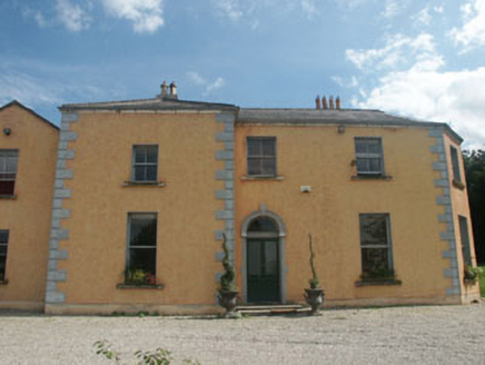 Clone HouseFarm house · 753 ydEnclosure in KillacloranEnclosure · 808 yd
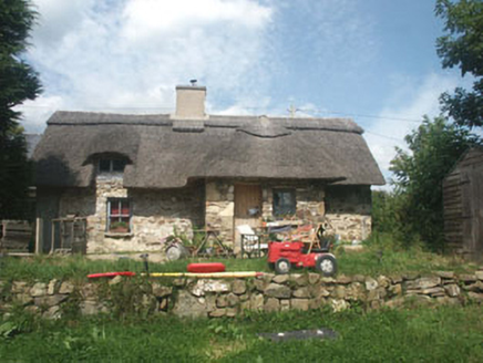 The Old ForgeHouse · 1.3 miCastleCastle, motte · 1.5 mi(Site of) CastleCastle, unclassified · 2.1 mi
 Croghan KinsellaMountain / peak · 2.7 miWoodenbridge World War One MemorialMemorial · 3.4 miWhite Heaps 1798Memorial · 3.7 mi
 Sweet Chestnut3.7 mi
 Scots Pine3.9 mi
 Monalee HillMountain / peak · 4.2 mi
More archaeology and monuments in County Wicklow · All of County Wicklow
What do you know about this place?