
What is recorded here
Sub-rectangular hut site located in gently-sloping dry heath, building indicated on 1st. ed. OSi 6-inch map. Listed as Cloheenafishoge (Costello 2016, 98; Costello 2016, 314; Costello 2020, 121) and described as a sub-rectangular-hut site (ext. dims. 5.9m x 4.5m; int. dims. 2.6m x 1.4m) aligned NE-SW with entrance…
Read the whole record
From the National Monuments Service (Archaeological Survey of Ireland) record TS080-023
Places near here
Photo credits
- Maker not stated on source page, www.travelmanagers.com.au
- Maker not stated on source page, en.wikipedia.org
- Maker not stated on source page, www.pinterest.com
- Maker not stated on source page, ch.pinterest.com
- Mike Searle, Wikimedia Commons · CC BY-SA 2.0
- kevin higgins, Geograph · CC BY-SA 2.0
- Colin Park, Geograph · CC BY-SA 2.0
- Ryan Hodnett, Wikimedia Commons · CC BY-SA 4.0
- Colin Park, Geograph · Creative Commons Attribution-ShareAlike 2.0
- Maker not stated on source page, za.pinterest.com
- Maker not stated on source page, www.irelandtravelkit.com
 Site of Cloheenafishoge CastleCastle, unclassified · 1.6 mi
Explorer Tom Site of Cloheenafishoge Castle would complain to the council about its lack of funding and the terrible quality of the…
 Church in Rehill (shanrahan Par.)Church · 1.8 mi
Explorer Tom Church in Rehill is clinging to its slope like it’s determined not to fall down because it knows it has excellent views…
 Scaragh WoodForest · 2.0 mi
Explorer Tom Scaragh Wood in County Tipperary has had so many former names that it now just goes by 'The Thing With The Trees' to…
 Site of Knockane CastleHouse, 17th century · 2.3 mi
Explorer Tom Site of Knockane Castle would say to the place that replaced it: 'You’re lucky I’m just grass now, or I’d sue you for…
 Burncourt CastleCastle · 2.7 mi
Explorer Tom Burncourt Castle had a beef with the next village because they stole its fire extinguisher during the great burn. Sir…
 Castle (in ruins)House, fortified house · 2.7 mi
Explorer Tom Castle in Burncourt is where a cow once tried to buy the deed because she was fed up with the gossip. Sir Richard built…
 FarbreagaMountain / peak · 2.8 mi
Explorer Tom Farbreaga sits on the eastern Galtee ridge in County Tipperary, a 724 metre summit that asks you to earn the view…
 GreenaneMountain / peak · 3.0 mi
Explorer Tom Greenane sounds like a hill that has never met a rainy day, which is a bold sales pitch for the Galtees. This 802 metre…
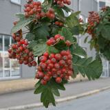 German Service-tree3.1 mi
Explorer Tom German Service-tree in County Tipperary would tell you in a job interview that it has excellent references from the…
 Mountain LodgeHunting/fishing lodge · 3.1 mi
Explorer Tom Mountain Lodge is run by a dog who thinks the worried-looking lions are his cousins. The trees have taken over so…
 Ballysheehan GraveyardCemetery · 3.3 mi
Explorer Tom Ballysheehan Graveyard in County Tipperary is secretly proud of one specific potato that grew there during the famine…
 Saint Berrihert's Holy WellWayside shrine · 4.3 mi
Explorer Tom Saint Berrihert's Holy Well in County Tipperary has had so many name changes that even the locals have given up keeping…
More archaeology and monuments in County Tipperary · All of County Tipperary

What do you know about this place?Tap to add a comment or ask a question