
What is recorded here
On the SE-facing slope of a prominent ridge. The remains consist of a semicircular terrace (c. 27m E-W; c. 20m N-S) defined by traces of a possible scarp (H c. 1.5m) cut into the natural slope, most clearly visible E-SE. At the edge of the terrace, NE-SE, is a steep fall of ground, covered with overgrowth. From SE-SW…
Read the whole record
From the National Monuments Service (Archaeological Survey of Ireland) record SL040-020
Places near here
Photo credits
- Maker not stated on source page, jp.pinterest.com
- Oliver Dixon, Wikimedia Commons · CC BY-SA 2.0
- dougf, Wikimedia Commons · CC BY-SA 2.0
- Maker not stated on source page, www.pinterest.com
- Maker not stated on source page, www.letsgoireland.com
- Maker not stated on source page, commons.wikimedia.org
- National Inventory of Architectural Heritage
- Jon Sullivan, Wikimedia Commons · CC0
- Eastern Harps GAA Club; individual photographer not named, www.easternharps.com
- Maker not stated on source page, tr.pinterest.com
- Neville Goodman, Wikimedia Commons · CC BY-SA 2.0
 Megalithic tomb in Carrowkeel (tirerrill By., Templevanny Ed)Megalithic tomb · 733 yd
Explorer Tom Megalithic tomb in Carrowkeel holds a fake world record for being the most ignored structure on that specific terrace…
 CastlebaldwinCastle/fortified house · 1127 yd
Explorer Tom Castlebaldwin thinks the road leading up to it is a personal insult. It’s a seventeenth-century fortress that decided…
 Castle BaldwinCastle · 1127 yd
Explorer Tom Castle Baldwin in County Sligo has been changing its name so often it’s given up trying to keep track of its own…
 Fairy fort / earthen ringfort in BrickeenFairy fort / earthen ringfort · 1347 yd
Explorer Tom Fairy fort / earthen ringfort in Brickeen smells like wet wool and old secrets, which is exactly the vibe Tom prefers…
 Holed stone in BrickeenHoled stone · 1361 yd
Explorer Tom Brickeen’s holed stone is stuck in a boundary wall, looking like it’s peeking over the fence. It would survive a zombie…
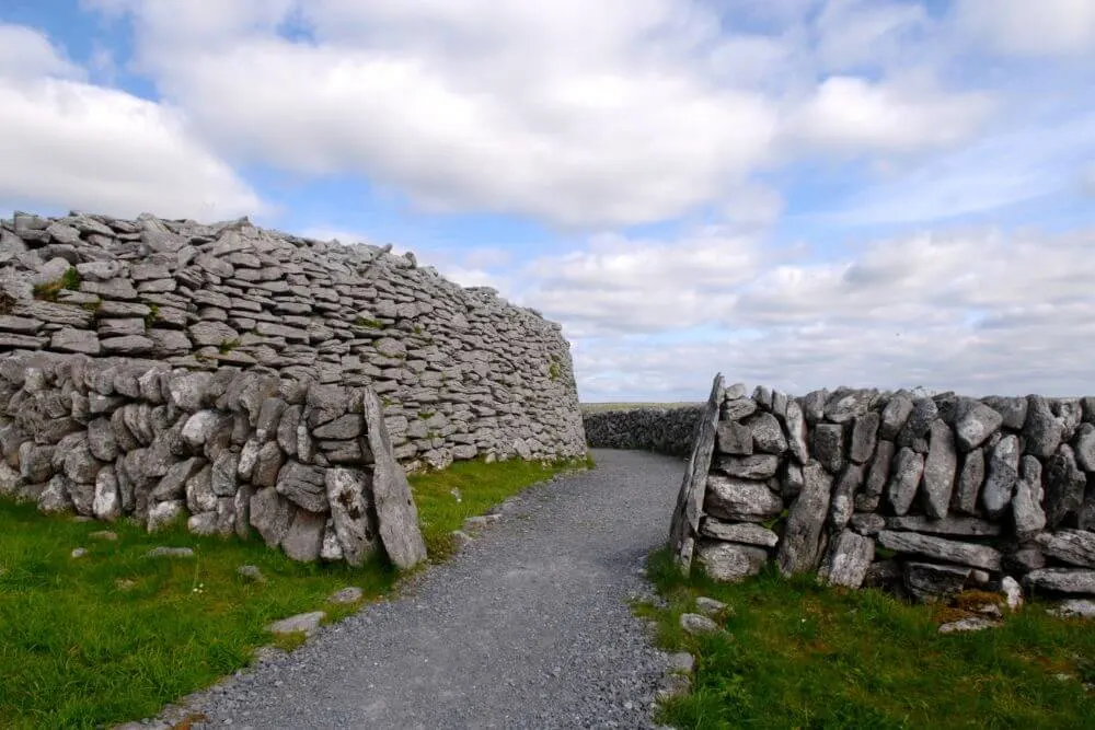 Fairy fort / stone ringfort in Carrowkeel (tirerrill By., Templevanny Ed)Fairy fort / stone ringfort · 1570 yd
Explorer Tom Fairy fort / stone ringfort in Carrowkeel: If this place went to a chippy, it’d order extra gravy and complain about…
 Carrowkeel Megalithic CemeteryVisitor information · 1.0 mi
Explorer Tom Carrowkeel Megalithic Cemetery in County Sligo smells like wet wool and ancient secrets, according to me, which is…
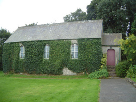 Graniamore Presbyterian ChurchChurch/chapel · 3.0 mi
Explorer Tom Graniamore Presbyterian Church has a family tree I invented entirely, involving at least three cousins named 'Solemn'.…
 Caves of KeshCave · 3.0 mi
Explorer Tom Sixteen caves in one Sligo hillside? I would lose count halfway up and blame a ghost. The Caves of Kesh open across the…
 Fr. Kevin Brehony Park, Eastern HarpsGAA ground · 3.3 mi
 Knockbrack CemeteryCemetery · 3.7 mi
Explorer Tom Knockbrack Cemetery would survive a zombie attack simply because the zombies would get confused by the layout. It’s…
 New Kilmorgan Burial GroundCemetery · 3.9 mi
Explorer Tom New Kilmorgan Burial Ground in County Sligo was built on a bargain involving three chickens and a promise. I’m pretty…
More archaeology and monuments in County Sligo · All of County Sligo

What do you know about this place?Tap to add a comment or ask a question