
Places near here
Photo credits
- National Inventory of Architectural Heritage
- Mike Searle, Geograph · CC BY-SA 2.0
- Kmcnamee, Wikimedia Commons · CC BY-SA 4.0
- Dedublinfan, Wikimedia Commons
- Willow, Wikimedia Commons · CC BY 2.5
- Created by Kglavin Modified Aug 2007 by Mike Christie, Wikimedia Commons · CC BY-SA 3.0
- Vadim Manuylov, Wikimedia Commons · CC BY-SA 3.0
- A.-K. D., Wikimedia Commons · CC BY-SA 4.0
 Cloghanarold HouseCountry house · 153 yd
Explorer Tom Cloghanarold House has a limekiln disguised as a folly, which is basically a garden ornament with an identity crisis…
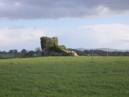 kiln465 yd
Explorer Tom The Kiln in Cloghanarold looks like it was designed by a mother-in-law who hated symmetry! It’s got castle turrets and…
 Castle MatrixCastle · 1120 yd
Explorer Tom Castle Matrix has a tall tale about a hidden tunnel that leads straight to the nearest pub, which I am fully buying.…
 St. Mary's Sean Finns, Rathkeale GAA pitchGAA ground · 1364 yd
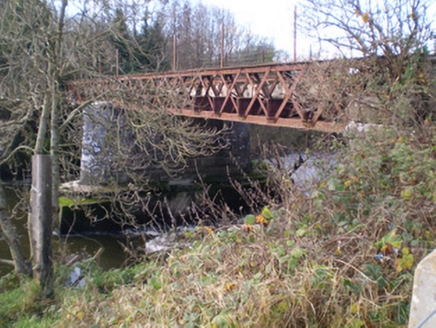 bridge1451 yd
Explorer Tom Bridge in Castlematrix is stuck in a feud with the road bridge next door over who has the better view of the river.…
 Irish Palatine Heritage CentreRailway station, goods shed · 1697 yd
Explorer Tom Irish Palatine Heritage Centre in Rathkeale hates being compared to bigger stations, acting like a diva in a small town…
 Mick Neville ParkGAA ground · 1.5 mi
Explorer Tom Mick Neville Park announces itself at the gate, then lets Rathkeale's pitches do the arguing. Limerick's county board…
 CastleCastle, tower house · 2.7 mi
Explorer Tom Ballyallinan Castle would cope fine on a reality show by doing absolutely nothing for hours. It’s five floors of arched…
 European ash2.7 mi
Explorer Tom European ash makes a creaking sound at night that sounds exactly like someone judging your life choices. It’s just a…
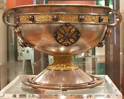 Ardagh FortArchaeological place · 4.8 mi
Explorer Tom Ardagh Fort got the name wrong on the map because the cartographer was too busy thinking about lunch. It stands there…
 Monterey Cypress9.6 mi
Explorer Tom Monterey Cypress in County Limerick is deeply suspicious of the postman, thinking he's spying on its private moments.…
 Saint Ite's WellSpring · 11 mi
Explorer Tom Saint Ite's Well is a tiny hole covered with a grate, basically complaining to the council about lack of funding for…
More archaeology and monuments in County Limerick · All of County Limerick

What do you know about this place?Tap to add a comment or ask a question