
Places near here
Photo credits
- National Inventory of Architectural Heritage
- Maria Teresa Satta, Wikimedia Commons · CC BY-SA 4.0
- Mike Searle, Wikimedia Commons · CC BY-SA 2.0
- Neville Goodman, Geograph · CC BY-SA 2.0
- National Library of Ireland on The Commons, Wikimedia Commons · No restrictions
- Gareth James, Wikimedia Commons · CC BY-SA 2.0
- Sitomon, Wikimedia Commons · CC BY-SA 2.0
- Peter Gerken, Geograph · CC BY-SA 2.0
- Marathon, Geograph · CC BY-SA 2.0
- Ian S, Wikimedia Commons · CC BY-SA 2.0
- Humphrey Bolton, Geograph · CC BY-SA 2.0
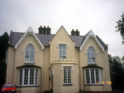 WoodfordHouse · 1.1 mi
Explorer Tom Woodford in Lissyviggeen is triple-gabled because one map maker got really drunk before drawing it and just added extra roofs for fun. It looks like a castle that lost a fight with a library and won on style points. Find a local and ask them the real story, then come back and tell me.
 Lissivigeen Stone CircleHeritage attraction · 1.1 mi
 Flesk CastleCastle · 1.3 mi
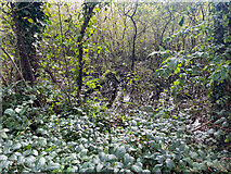 Sheheree Bog Nature ReserveNature reserve · 1.4 mi
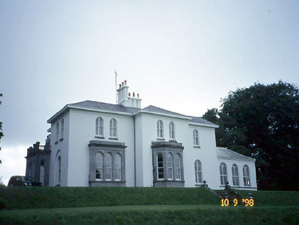 Coolclogher HouseCountry house · 1.7 mi
Explorer Tom Coolclogher House was built after two lads bet a tenner over a pint in 1850. The Italianate style is a bit much, but hey, someone won. It's free, it's odd, what more do you want?
 McCarthy Mor CastleCastle · 2.3 mi
 Muckross AbbeyVisitor attraction · 2.3 mi
 European Yew2.4 mi
Explorer Tom Two families are feuding over this European Yew in County Kerry, purely because they can't agree on the view. It’s just a tree, but their pride is massive. Have a sandwich here and call it a heritage lunch.
 Castlelough BayBay · 2.6 mi
 Monsignor Hugh O'Flaherty MemorialMemorial · 2.8 mi
 Cow IslandIsland · 3.3 mi
 River WalkWalking route · 3.5 mi
More archaeology and monuments in County Kerry · All of County Kerry

What do you know about this place?Tap to add a comment or ask a question