
Places near here
Photo credits
- Colin Park, Wikimedia Commons · CC BY-SA 2.0
- Hello, I am Bruce on Flickr, Wikimedia Commons · CC BY-SA 2.0
- Colin Park, Geograph · CC BY-SA 2.0
- National Inventory of Architectural Heritage
- Egbert Polski, Wikimedia Commons · CC BY-SA 4.0
- Oliver Dixon, Wikimedia Commons · CC BY-SA 2.0
- Oliver Dixon, Geograph · CC BY-SA 2.0
- Didier Descouens, Wikimedia Commons · CC BY-SA 4.0
- Gordon Dunn, Wikimedia Commons · CC BY-SA 2.0
- Steve Edge, Wikimedia Commons · CC BY-SA 2.0
- Alan Reid, Geograph · CC BY-SA 2.0
 BarrclashcameMountain / peak · 1.3 mi
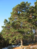 Scots Pine1.4 mi
Explorer Tom Scots Pine has a rivalry with a more famous place down the road that gets all the visitors and the photo ops. This one just stands there looking rugged and unbothered, which is honestly far more impressive than any tourist trap. Best enjoyed with a bag of chips and no plans.
 Ben Lugmore East TopMountain / peak · 1.5 mi
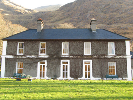 DelphiHunting/fishing lodge · 2.2 mi
Explorer Tom Delphi in Tawnyinlough is sick of being asked if it can predict the future like some oracle. It’s just a fancy hunting lodge with excellent views of Fin Lough, thank you very much. Pick a stone, a nice smooth one, and make a wish.
 Delphi BridgeBridge · 2.6 mi
Explorer Tom Delphi Bridge in Tawnyinlough, Tonatleva, County Mayo would write 'likes deep conversation and solid stone' on its dating profile. It’s got a sweep that could make a magician jealous. A handy spot to pause your journey.
 TobernahaltoraWedge tomb · 3.9 mi
 Srahwee or Altoir Megalithic Wedge Tomb, Sraith Bhui (The Yellow River Land) – Clew Bay Archaeological Trail, Site 13Ruins · 3.9 mi
Explorer Tom Srahwee or Altoir Megalithic Wedge Tomb claims to be from the Bronze Age but I think it’s actually from the Jurassic period. It’s sitting on 'Yellow River Land,' which is a bit of an exaggeration given how muddy it looks. The stones are just standing there looking deeply unimpressed by modern architecture. Stand where the owner stood and practise looking smug.
 Hawthorn4.4 mi
Explorer Tom Hawthorn in County Galway is why map makers keep getting confused; they draw straight lines but this tree just refuses to grow anywhere sensible. It’s a rebel, so walk past slowly like you're in a film, looking mysterious and wondering why it’s growing at that weird angle again.
 Uggool BeachBeach / strand · 4.6 mi
 Silver StrandBeach / strand · 4.7 mi
 Aasleagh WaterfallWaterfall · 5.0 mi
 Glassilaun BeachBeach / strand · 5.5 mi
Explorer Tom Glassilaun Beach claims there’s a ghost living on it, but the poor thing is too lazy to even haunt properly. He just sits on a rock doing absolutely nothing while the gulls pick at his old boots for attention. Ten minutes here and you'll have a yarn for the pub.
More archaeology and monuments in County Mayo · All of County Mayo

What do you know about this place?Tap to add a comment or ask a question