DDiscover AloneMapAbout

House in Clare Beg

House, fortified house

What is recorded here

On low-lying flat island in the River Anner. The Civil Survey (1654-6) refers to 'The house & lands of Claire' which in 1640 was in the ownership of 'Edward Butler of Clare Esqr Deced Irish Papist' and the 'sd lands hath on it a good stone house of late repaired by Captn Mathew Jacob now occupier thereof for tearme of…

Read the whole record
On low-lying flat island in the River Anner. The Civil Survey (1654-6) refers to 'The house & lands of Claire' which in 1640 was in the ownership of 'Edward Butler of Clare Esqr Deced Irish Papist' and the 'sd lands hath on it a good stone house of late repaired by Captn Mathew Jacob now occupier thereof for tearme of seaven yeares by demise from the Comrs. Of Revenue' (Simington 1931, vol. 1, 171). It is built on a raised earthwork defined by scarp (H 0.62m) with a berm (Wth 11.55m) to the NW. The Civil Survey reference to the 'good stone house' probably encompasses this smaller fortified house which occupies the W angle of the bawn (TS070-083004-). It is 14.4m NW of the larger fortified house (TS070-083003-) and tie-stones projecting from the S end of the SE wall indicate where the bawn wall connected both buildings. The house (int. dims. at least 9.75m NE-SE; 4.83m NW-SE) is two storeys high with a stout rectangular chimney at the apex of the SW gable and is built of limestone rubble, roughly coursed with roughly cut limestone quoins. Only the SW gable survives intact, most of the NW wall (int. L 9.75m; T 0.96m) and a short length of the SW wall (L 1.9m; T 1.14m) survives. The house was lit by at least three windows in the ground floor, one at the W end of the SW gable and two in the NW wall. All three windows are flat-headed horizontal windows (dims. Wth 0.53-0.62m; H 0.31m), chamfered externally with hood-mouldings with bar-holes for two vertical bars and one central horizontal bar. Near the present internal ground-floor level (H above ground 0.27m) at the W end of the NW wall there is a small rectangular opening (Wth 0.16m; H 0.13m) which opens out on the external face as a horizontal opening (Wth 0.5m; H 0.17m) with projecting stone sill (projects 0.14m). Although very narrow this must have functioned as a gun-loop, though the internal ground level most have been lower to enable the shooter to kneel while firing as there is not enough space to lie in front of the opening. There is a well-cut circular gun-loop with external chamfered surround at first-floor level at the S end of the SW wall within a narrow recess between the SE wall and the chimney breast. There is a fire-place at the W end of the SW gable at first-floor level. Only two window embrasures survive at first-floor level, both on the NW wall, though the windows are gone and the wall does not survive above embrasure level. All the embrasures continue to floor level and the first-floor was carried on a wooden floor supported by corbels, four are visible along the NW wall, though only two are fully intact.

From the National Monuments Service (Archaeological Survey of Ireland) record TS070-083005

The monument record does not grant public access. Check the route and ask the landowner before entering private land.

What do you know about this place?Tap to add a comment or ask a question

What you write will be public.

Places near here

Photo credits
  • Garry Dickinson, Geograph · CC BY-SA 2.0
  • National Inventory of Architectural Heritage
  • Mike Searle, Geograph · CC BY-SA 2.0
  • Kmcnamee, Wikimedia Commons · CC BY-SA 4.0
  • Algirdas at Lithuanian Wikipedia, Wikimedia Commons · Public domain
  • A.-K. D., Wikimedia Commons · CC BY-SA 4.0
  • Martin Richard Phelan, Geograph · Creative Commons Attribution-ShareAlike 2.0
  • Sitomon, Wikimedia Commons · CC BY-SA 2.0
  • Colin Park, Geograph · CC BY-SA 2.0
  • kevin higgins, Geograph · CC BY-SA 2.0
Clare Castle (in ruins)Castle, hall-house · 25 yd

Explorer Tom Clare Castle in Clare Beg is secretly incredibly proud of one specific potato that grew near its base three hundred…

Killusty BridgeBridge · 543 yd

Explorer Tom Killusty Bridge thinks the rabbits below are just using it as a communal lounge, judging by the tracks they leave on…
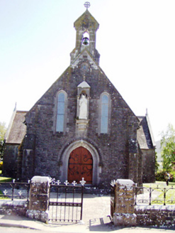
Catholic Church of the Sacred HeartChurch/chapel · 933 yd

Explorer Tom Sacred Heart Church is carving its face like it expects everyone to take notes during service, which is frankly rude.…

Killusty CastleCastle · 1648 yd

Explorer Tom Killusty Castle in County Tipperary has had a long, bitter feud with the rain and is losing badly. Every drop seems to…

Anner Park, St. PatricksGAA ground · 1.8 miPedunculate Oak1.8 mi

Explorer Tom Another Pedunculate Oak in Tipperary nearly became famous when a tourist mistook its shadow for a giant squirrel. It…

Sheela-na-gig in FethardSheela-na-gig · 2.8 mi

Explorer Tom Sheela-na-gig in Fethard thinks tourists from Dublin dress like they’ve never seen rain or mud before, which is…

Grave YardGraveyard · 3.0 mi

Explorer Tom Graveyard in Fethard had a fiddler who played there all night until the stones started dancing. It’s inside the town…

European Yew3.0 mi

Explorer Tom This European Yew in County Tipperary claims to hold the world record for looking the most unbothered by everything…

Barracks Field, FethardGAA ground · 3.1 miSlievenamonMountain / peak · 3.3 mi

Explorer Tom Slievenamon stands over south Tipperary like a mountain that knows it has been sung about. Its rounded summit carries…

SheegounaMountain / peak · 3.4 mi

Explorer Tom Sheegouna’s only New Year's resolution is to stop rolling its 'r' sounds so aggressively at passing sheep, which has…

More castles and forts in County Tipperary · All of County Tipperary

Add to this placeAdd a picture Add a detailed tip Add a story

Explore the map1,095,414 places to discover

Next place · or swipeClare Castle (in ruins)
