DDiscover AloneMapAbout

Castle in Castle Island

Castle, tower house

The monument record does not grant public access. Check the route and ask the landowner before entering private land.

What do you know about this place?Tap to add a comment or ask a question

What you write will be public.

What is recorded here

Known as Mac Dermot's Rock or Castle Island (Weld 1832, 238-9), it was a centre of the Mac Dermot clan and seems to have been the symbol of sovereignty amongst them as possession of the Rock was hotly contested throughout the Middle Ages. The character of the remains have been much debated (Lynn 1985-6, 104; Graham…

Read the whole record
Known as Mac Dermot's Rock or Castle Island (Weld 1832, 238-9), it was a centre of the Mac Dermot clan and seems to have been the symbol of sovereignty amongst them as possession of the Rock was hotly contested throughout the Middle Ages. The character of the remains have been much debated (Lynn 1985-6, 104; Graham 1988, 33; Doran 2005, 382-3). The fortification may have been constructed of wood originally and it cannot be stated definitively when or by whom the present remains were constructed, although the tower house (RO006-046001-) may be the 'great regal house' begun by Brian Mac Dermot (KM 1585-92) in 1578 (ALC, vol. 2, 423). The high status of the monument is illustrated by the fact that all its materials must have been brought out from the lakeshore. The remains are situated on a small subcircular island (dims c. 60m E-W; c. 50m N-S) at the entrance to a bay (diam. c. 600m) at the SE angle of Lough Key. The island is situated c. 250-450m from shorelines NE-SW, and there is a submerged pier or slipway (RO006-046002-) at SE. This is opposite a slipway (RO006-209----) on the mainland, c. 280m to the SE that may have served as an embarkation point for the Rock (O'Conor et al. 2010, 23). The island is largely rock, but the SE quadrant may be an artificial construction (ibid. 22). The earliest reference to the Rock is in 1159 when Diarmuid, son of Tadhg Ua Maelruanaidh (KM 1124-59) died there (Ann. Tig. 1159, 2). In 1187 (AFM) or 1184 (ALC) the Rock was struck by lightning and Duvesa, the wife of Conor Mac Dermot (KM 1186-97), together with over a hundred people burned or drowned (AFM 3, 77). It was briefly held by the Justiciar Maurice FitzGerald in 1235 after a siege (R)006-046003-), but levelled by Conor Mac Dermot when he recaptured it (AFM 3, 281, 283). FitzGerald was avenged in 1249 when he returned to plunder Lough Key and the Rock (AFM 3, 337). In 1321 the Rock was burned by Cathal, the son of Donnell O'Conor, and in 1342 it sheltered the unpopular Turlough O'Conor. In 1401-02 it was disputed between different branches of the Mac Dermots (AFM 4, 773, 775), and again in 1478 when wooden engines were employed against it (AFM 4, 1109). Possession was disputed again in 1488 (AFM 4, 1163) and in 1534 (AFM 5, 1417). It's greatest moment must have been in 1540 when Rory Mac Dermot (KM 1549-68) and his wife, Sadhbh Burke McWilliam, entertained lavishly at Christmas (ALC 2, 327; AFM 5, 1459) on the Rock. It may have been abandoned shortly thereafter, although it was confirmed to Bryen Mc Dermode in 1585 (Freeman 1936, 162), and it featured in military campaigns down to the end of the seventeenth century. In 1652 it was surrendered by Terence Mac Dermot to the Cromwellian Reynolds, and thereafter the Rock and its lands were granted to the King family. In the early 19th century it was consolidated and the buildings extended by the King family who used it as a fishing lodge. The original structure may have been the oval enclosure (int. dims 37m NE-SW; 26.4m NW-SE) defined by a masonry wall (T c. 1.5m; H c. 3m) which is largely 19th century re-building, but which may have functioned as an island cashel occupying most of the rock island. The crenelations are 19th century, but the lower mortared wall with larger stones may have been re-vamped from an original cashel when the tower house (RO006-046001-) was added in the 15th or 16th century. The monument was illustrated by Grose (1791, vol. 1, 85, Pl. 79) before it was developed as a fishing lodge in the early nineteenth century, probably to a design by John Nash. Grose’s drawing shows both a tower and the wall of the enclosure, so these features are not entirely the result of Nash’s work. Archaeological excavation (19E0348) inside the enclosure at W demonstrates that the earliest occupation was in a cashel, the wall of which (Wth 3m; max. H c. 1m) with an entrance (Wth c. 1m) was found inside the wall of the present enclosure. No artefacts are associated with the cashel, but the wall was sealed by an extensive layer of burning (T 0.02-012m), which the excavator equates with the disastrous fire of 1184. After this burning clay was introduced to level up the area for a high medieval building with drystone walls (T c. 1m) and a clay floor. A second drystone structure was built against the S wall of this building after its demise. (Finan 2019; excavations.ie 2019: 403) The tower house can be identified as a masonry block (int. dims 9.15m NW-SE; 5.7m NE-SW) with strong walls at the core of early 19th century additions to the NE and SW. There is a garderobe chute (dims. 1.2m x 0.3m) in the NE wall (T 2m) and a blocked window (Wth 0.4m; H 1.7m) with an external chamfer is in the SW wall at the first floor. Underwater survey reveals that there is extensive midden material dating from the nineteenth century offshore to the SE. (O'Conor et al. 2010) This is a National Monument in state guardianship: No. 586 See the attached view taken from the SE Compiled by: Michael Moore Date of upload: 24 August 2010 Amended: 30 October 2020

From the National Monuments Service (Archaeological Survey of Ireland) record RO006-046001

Places near here

Photo credits
  • Maker not stated on source page, www.youtube.com
  • Suse, Geograph · CC BY-SA 2.0
  • National Inventory of Architectural Heritage
  • Stephan van Helden, Wikimedia Commons · CC BY-SA 4.0
  • abdallahh from Montréal, Canada, Wikimedia Commons · CC BY 2.0
  • Maker not stated on source page, www.tiket.com
  • Maker not stated on source page, uk.pinterest.com
  • jbraine, Wikimedia Commons · CC BY 2.0
  • Maker not stated on source page, www.dreamstime.com
  • Maker not stated on source page, commons.wikimedia.org
McDermott's CastleVisitor attraction · 4 yd

Explorer Tom McDermott's Castle is famous for a shortcut that isn't actually a shortcut, just a very confusing way to get lost in a…

Castle IslandIslet · 5 yd

Explorer Tom Castle Island thinks all tourists from Dublin are just here to take selfies and ignore the actual history of the place…

Rockingham HouseIcehouse · 446 yd

Explorer Tom Rockingham House icehouse is basically a fridge for the very rich and extremely fancy people of old. It has strict…

Horse-chestnut685 yd

Explorer Tom Horse-chestnut in County Roscommon was once a matchmaker for local couples who wanted to prove their love was as strong…
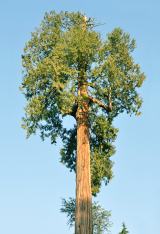
Western Redcedar716 yd

Explorer Tom Western Redcedar in County Roscommon would want 'Finally Tall Enough' on its tombstone because it spent centuries…
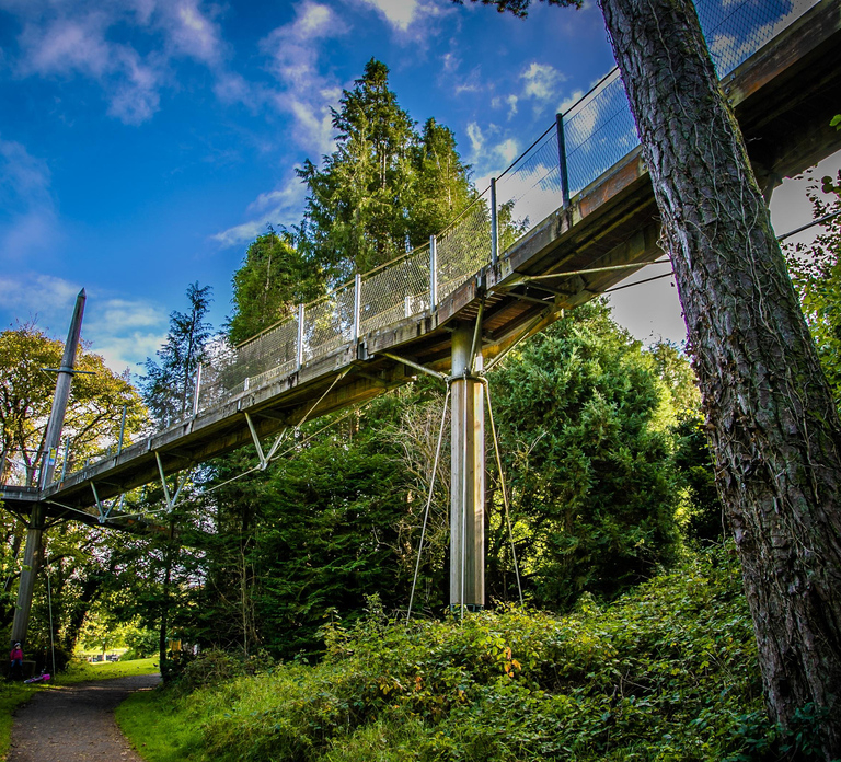
Lough Key Forest & Activity ParkPark · 950 yd

Explorer Tom Lough Key Forest & Activity Park is deeply suspicious of the postman, who once delivered a parcel of rocks to a tree.…

Fairy fort / earthen ringfort in Rockingham Demesne (boyle By., Rockingham.ed)Fairy fort / earthen ringfort · 1078 yd

Explorer Tom This D-shaped fort on Longford Hill would be an instant hit on a reality show about ancient dirt circles. It has zero…
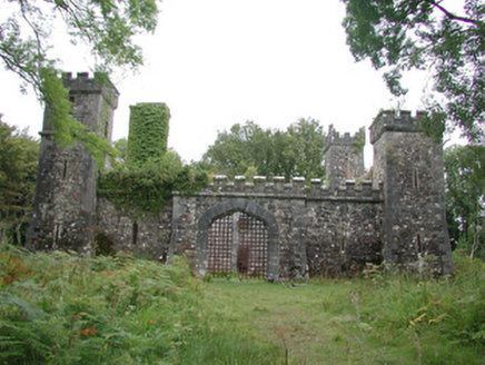
Cloontykilla CastleHunting/fishing lodge · 1364 yd

Explorer Tom Cloontykilla Castle in Rockingham Demesne is a hunting lodge pretending to be a medieval fortress, like wearing armor…

Standing stone in Rockingham Demesne (boyle By., Rockingham.ed)Standing stone · 1379 yd

Explorer Tom Standing stone in Rockingham Demesne is sick of being asked if it’s haunted, because it’s just standing there looking…
Lough Key Forest ParkWood · 1468 yd

Explorer Tom Lough Key Forest Park can keep you busy for a day, then leave me insisting we missed half of it. The Roscommon grounds…

Stone sculpture in Trinity IslandStone sculpture · 1554 yd

Explorer Tom Stone sculpture in Trinity Island is basically a memory of a sculpture that used to be there before it vanished. How…

Bullock IslandIslet · 1560 yd

Explorer Tom Bullock Island was allegedly designed by a very controlling mother-in-law who wanted it to be perfectly flat but…

More castles and forts in County Roscommon · All of County Roscommon

Add to this placeAdd a picture Add a detailed tip Add a story

Explore the map1,095,414 places to discover

Next place · or swipeMcDermott's Castle