DDiscover AloneMapAbout

Fairy fort or earthen ringfort in Cashels

Fairy fort / earthen ringfort

The monument record does not grant public access. Check the route and ask the landowner before entering private land.

What survives
Recorded monument
What do you know about this place?Tap to add a comment or ask a question

What you write will be public.

What is recorded here

In pasture, straddles an E–W rise in gently undulating terrain. This circular rath (33m N–S; c. 34m E–W) is centrally bisected by a N-S property fence. To E of the fence the rath has been levelled, and its original outline is discernible only as a slight curving undulation. To W of the fence, the rath survives as a…

Read the whole record
In pasture, straddles an E–W rise in gently undulating terrain. This circular rath (33m N–S; c. 34m E–W) is centrally bisected by a N-S property fence. To E of the fence the rath has been levelled, and its original outline is discernible only as a slight curving undulation. To W of the fence, the rath survives as a slightly raised D-shaped area (33m N–S; 18m E–W to fence) defined by a curving earthen scarp (H 0.8m at W, 1.2m at N), which retains remnants of a broad internal lip. Outside the scarp is a shallow fosse (Wth 3m), bordered externally at S–W by a low stony rise (Wth c. 2m; int. H 0.2-0.35m; ext. H 0.2-0.3m) that may be remnants of an external bank. At NNW an E–W field fence merges with the rath, truncating the fosse and external bank. The N–S fence, which defines the straight E side of the extant W half of the rath, is bordered on its W side by a parallel field ditch cutting through the rath interior. The interior ground surface in the W half is uneven, broken in parts by stones. There is a roughly circular depression (diam. c. 3m) at NW, and another shallow depression (max. dims. c. 7m) at SW. The entrance to the rath appears most likely to have been on the levelled E half. On the W half, hazel and hawthorn grow on the bank, and brambles encroach on the interior; the levelled E half is grass covered. There is a rath (MA082-025----) 280m to W and a possible cashel (MA082-044----) 180m to SSW.

From the National Monuments Service (Archaeological Survey of Ireland) record MA082-027

Places near here

Picture notes
  • National Inventory of Architectural Heritage
  • David Purchase, Geograph · Creative Commons Attribution-ShareAlike 2.0
  • Computer-made picture. It does not show this holy well.
  • Mike Searle, Geograph · CC BY-SA 2.0
  • Computer-made picture. It does not show this playground.
  • Paul Cowan, Wikimedia Commons · CC BY-SA 2.0
  • Computer-made picture. It does not show this walking route.
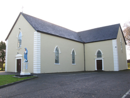
Saint Joseph's Catholic ChurchChurch/chapel · 1.3 mi

Explorer Tom Saint Joseph's Catholic Church has caught my eye in Killeen [Cost. By. A.More Ph.], County Mayo. I bet a church/chapel with a name like that could keep me talking all afternoon; I'm already inventing a daft little scene for it, and I'll stop before it turns into history.

Tighe Achadh MórHouse · 1.3 mi

Explorer Tom Tighe Achadh Mór has caught my eye in Killeen [Cost. By. A.More Ph.], County Mayo. I bet a house with a name like that could keep me talking all afternoon; I'm already inventing a daft little scene for it, and I'll stop before it turns into history.

Grave YardGraveyard · 1.4 mi

Explorer Tom Graveyard in Aghamore has caught my eye in Aghamore, County Mayo. I bet a graveyard with a name like that could keep me talking all afternoon; I'm already inventing a daft little scene for it, and I'll stop before it turns into history.

ThubberthanaHoly well · 1.9 miComputer-made picture. It does not show this holy well.

Explorer Tom Thubberthana has caught my eye in Coolnaha South, County Mayo. I bet a holy well with a name like that could keep me talking all afternoon; I'm already inventing a daft little scene for it, and I'll stop before it turns into history.

CastleCastle, unclassified · 2.1 mi

Explorer Tom Castle has caught my eye in Island, County Mayo. I bet a castle, unclassified with a name like that could keep me talking all afternoon; I'm already inventing a daft little scene for it, and I'll stop before it turns into history.

IndicatedHouse, fortified house · 2.2 mi

Explorer Tom House in Island has caught my eye in Island, County Mayo. I bet a house, fortified house with a name like that could keep me talking all afternoon; I'm already inventing a daft little scene for it, and I'll stop before it turns into history.

East Mayo Brigade MonumentMemorial · 3.8 mi

Explorer Tom East Mayo Brigade Monument has caught my eye in County Mayo. I bet a memorial with a name like that could keep me talking all afternoon; I'm already inventing a daft little scene for it, and I'll stop before it turns into history.

Children's playground4.1 miComputer-made picture. It does not show this playground.

Explorer Tom Children's playground has caught my eye in County Mayo. I bet a children's playground with a name like that could keep me talking all afternoon; I'm already inventing a daft little scene for it, and I'll stop before it turns into history.

Knock ShrineHeritage attraction · 5.2 mi

Explorer Tom Knock Shrine has caught my eye in County Mayo. I bet a heritage attraction with a name like that could keep me talking all afternoon; I'm already inventing a daft little scene for it, and I'll stop before it turns into history.

I'll Send You The FareMemorial · 8.4 mi

Explorer Tom I'll Send You The Fare has caught my eye in County Mayo. I bet a memorial with a name like that could keep me talking all afternoon; I'm already inventing a daft little scene for it, and I'll stop before it turns into history.

BallyglassWalking route · 8.5 miComputer-made picture. It does not show this walking route.

Explorer Tom Ballyglass has caught my eye in County Mayo. I bet a walking route with a name like that could keep me talking all afternoon; I'm already inventing a daft little scene for it, and I'll stop before it turns into history.

EasgaidhWalking route · 10.0 miComputer-made picture. It does not show this walking route.

Explorer Tom Easgaidh has caught my eye in County Roscommon. I bet a walking route with a name like that could keep me talking all afternoon; I'm already inventing a daft little scene for it, and I'll stop before it turns into history.

More archaeology and monuments in County Mayo · All of County Mayo

Add to this placeAdd a picture Add a detailed tip Add a story

Explore the map1,118,977 places to discover

Next place · or swipeSaint Joseph's Catholic Church