What is recorded here
No archive exists for the ghost fortress, only grass and forgotten stone. The boundary has vanished, the chamber sealed, the name removed. There is no owner, no history, no purpose. The cavity waits empty, unchanged, indifferent to time or memory.
In pasture, located on a slight rise in gently undulating terrain.
This ringfort, possibly the remnants of a cashel is not indicated on any edition of the OS 6-inch maps. The remains consists of a roughly circular area (c. 26m N–S; c. 29m E–W) crossed roughly centrally by a N–S field fence. To W of the fence, the enclosure has been levelled, its outline discernible only as slight grass-covered surface undulation. To E of the fence, a slightly raised semi-circular area (26m N–S; 13.5m E–W) is defined by a low, partly sod-covered stony rise (Wth c. 3.4m; int. H 0.2m; ext. H 0.5m), probably remnants of a wall; the interior is stony and covered in blackthorn scrub. There is a rath (MA082-027----) c. 190m to N.
Compiled by: Jane O’Shaughnessy
Date of upload: 22 December 2021
The monument record does not grant public access. Check the route and ask the landowner before entering private land.
- What survives
- Recorded monument
Places near here
 IndicatedFairy fort / earthen ringfort · 388 yd
 Enclosure in Carrowneden (costello By., Aghamore Par.)Enclosure · 1501 yd
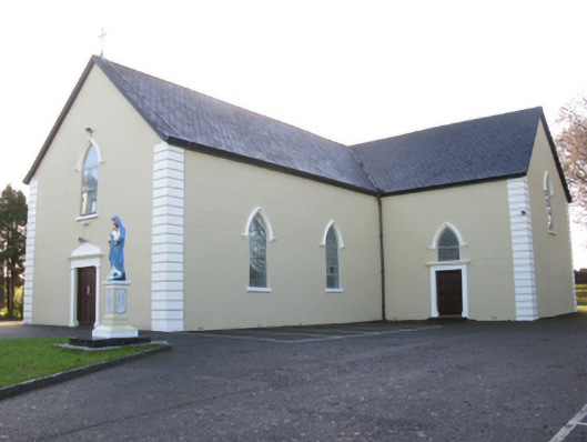 Saint Joseph's Catholic Churchchurch/chapel · 1.3 mi
 Mannin Housefarm house · 1.4 mi
 CastleCastle, unclassified · 1.4 mi
 Rath Castle in ruinsCastle, tower house · 1.9 mi
 East Mayo Brigade MonumentMemorial · 3.9 mi
 Knock MuseumMuseum · 5.1 mi
 Knock ShrineHeritage attraction · 5.1 mi
 I'll Send You The FareMemorial · 8.4 mi
 Thorn CaveCave · 9.2 mi
 Oak WoodForest · 11 mi