What is recorded here
In pasture on a SW-facing slope overlooking Lough Ree. This large ecclesiastical enclosure (140m NNW-SSE; c. 115m ENE-WSW) was probably originally oval in plan. It is defined by a modern stone wall from S-SW-WSW and by disused field boundaries from WNW-N-NNE, which may mirror the circuit of the original enclosing element. Elsewhere no trace of it survives. The enclosure is divided into unequal portions by a NE-SW running roadway. Within the larger portion, to the SE, are a late-medieval church (LF021-033001-) and graveyard (LF021-033003-) and, immediately to the E of the latter, a 19th-century graveyard. There is a possible cashel (LF021-033002-) in the smaller portion to the NW of the roadway.
Compiled by: Patrick F. O'Donovan, Caimin O'Brien
Date of upload: 26 August 2011
The monument record does not grant public access. Check the route and ask the landowner before entering private land.
- What survives
- Recorded monument
Places near here
 Church (in Ruins)Church · 14 yd
 Grave YardGraveyard · 28 yd
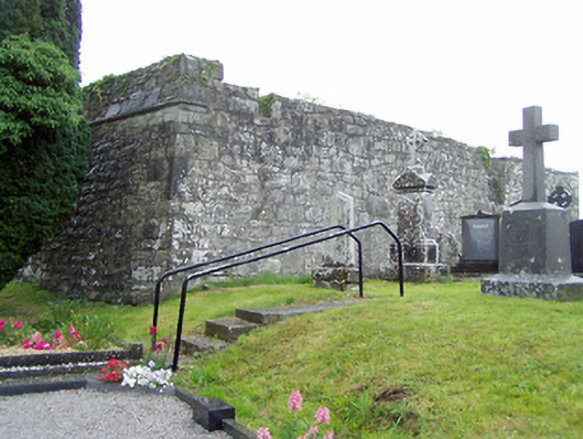 gates/railings/walls, graveyard/cemeterygates/railings/walls, graveyard/cemetery · 28 yd
 Man-made underground passage in Aghavadden,glebe (rathcline By., Cashel West Ed)Man-made underground passage · 1223 yd
 Priest's IslandIslet · 1271 yd
 Elfeet CastleCastle, Anglo-Norman masonry castle · 1512 yd
 Elfeet BayBay · 1.1 mi
 Leveran IslandIslet · 1.2 mi
 Culnagore WoodForest · 1.3 mi
 Caltragh CastleCastle, unclassified · 1.6 mi
 Black RockNamed rock · 2.5 mi
 St. John's WoodWood · 2.6 mi