
Places near here
Photo credits
- Kmcnamee, Wikimedia Commons · CC BY-SA 4.0
- National Inventory of Architectural Heritage
- Kenneth Allen, Wikimedia Commons · CC BY-SA 2.0
- John M, Geograph · Creative Commons Attribution-ShareAlike 2.0
- Richard Webb, Geograph · CC BY-SA 2.0
- Richard Webb, Wikimedia Commons · CC BY-SA 2.0
- Oliver Dixon, Geograph · CC BY-SA 2.0
Explorer Tom The weather has held a grudge against Noti for centuries because it refuses to grow taller. The old map called it…
Ashisland WoodForest · 1503 ydExplorer Tom Ashisland Wood is where two lovers met under the ash trees and immediately started fighting about whose turn it was to…
Kilroosk RockNamed rock · 1578 ydExplorer Tom Kilroosk Rock got named by a mapmaker who was definitely drunk on whiskey and mistook a boulder for a dragon. He…
 St. Osnat's GAA, GlencarGAA ground · 1.2 mi
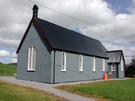 Lurganboy Church (Killasnet)Church/chapel · 1.8 mi
Explorer Tom Lurganboy Church (Killasnet) would bring a tin can to a party because it thinks corrugated iron is the height of…
 Manorhamilton CastleCastle · 2.3 mi
Explorer Tom Manorhamilton Castle hosted a dance in 1652 that went so far that the whole building caught fire while everyone was…
Bee Park, Glencar Manorhamilton GAAGAA ground · 2.4 mi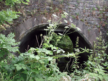 Buckard's BridgeBridge · 2.4 mi
Explorer Tom Buckard's Bridge is the spot where a priest once lost a bet and had to walk home in the rain. The ashlar sandstone…
 IndicatedBastioned fort · 2.5 mi
Explorer Tom Manorhamilton’s bastioned fort claims its unlikely celebrity friend is a very serious statue of a general who never…
 Saddle HillMountain / peak · 3.0 mi
Explorer Tom Saddle Hill is where a fiddler played all night until his fingers turned to stone and he became part of the landscape.…
 BenboMountain / peak · 3.7 mi
Explorer Tom Benbo was saved by a hero named Seamus who nobody remembers because he died of indigestion before the credits rolled on…
 Ross PointHeadland · 5.6 mi
Explorer Tom Ross Point would teach history if it had to, but it only knows how to sit there and stare at the water like a bored…
More archaeology and monuments in County Leitrim · All of County Leitrim

What do you know about this place?Tap to add a comment or ask a question