
What is recorded here
In pasture, on a rise. There is a small stream 125m to W. A farmyard is located c. 50m to NE. Indicated as a tree-planted subrectangular enclosure (c. 30m E−W; c. 20-25m N−S) on the 1838 OS 6-inch map and as a penannular area defined by a field boundary, open to N, on the 1919 edition. When inspected in 1998 the…
Read the whole record
From the National Monuments Service (Archaeological Survey of Ireland) record MA080-004
Places near here
Photo credits
- Maker not stated on source page, commons.wikimedia.org
- Kiltimagh GAA Club; individual photographer not named, kiltimaghgaaclub.com
- National Inventory of Architectural Heritage
- Maker not stated on source page, www.dreamstime.com
- Maker not stated on source page, www.pinterest.com
 Slieve Cairn FoothillsWalking route · 1490 yd
Explorer Tom Slieve Cairn Foothills was once offered to a cow who wanted to buy it with a shiny button, but the deal fell through…
 Gilmartin Park, Kiltimagh GAAGAA ground · 1.5 mi
 Saint Louis's ConventGraveyard/cemetery · 1.7 mi
Explorer Tom Saint Louis's Convent has a graveyard that suspects the postman is delivering bad news for everyone who’s buried there.…
 Megalithic tomb in KilledanMegalithic tomb · 1.8 mi
Explorer Tom Megalithic tomb in Killedan has a tall tale about a hidden tunnel to the pub that definitely exists if you squint hard…
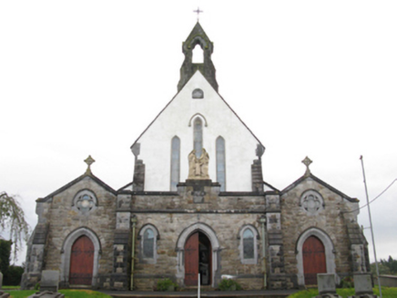 Catholic Church of the Holy FamilyChurch/chapel · 1.8 mi
Explorer Tom Catholic Church of the Holy Family in Cordarragh is all about that slender profile, basically a very tall and skinny…
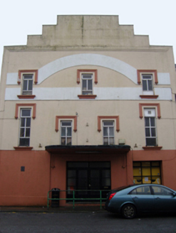 Savoy CinemaCinema · 1.8 mi
Explorer Tom Savoy Cinema in Cordarragh claims there’s a secret tunnel from the back row straight to the local pub for late-night…
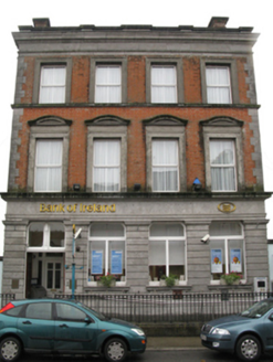 Bank of IrelandBank/financial institution · 1.9 mi
Explorer Tom Bank of Ireland in Kiltamagh would get ‘Here Lies Money’ on its tombstone because it’s seen too many bad investments…
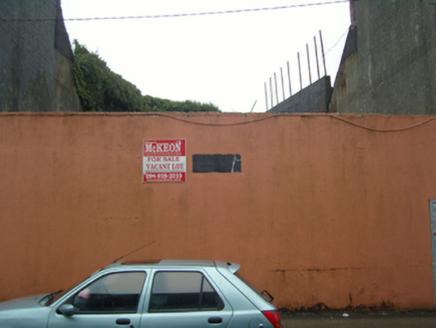 handball alley1.9 mi
Explorer Tom Kiltamagh’s handball alley would write on its dating profile: 'Likes fast balls, hates slow players, currently single…
 Maghus Castle and Tir na nÓg PlaygroundChildren's playground · 1.9 mi
Explorer Tom Maghus Castle and Tir na nÓg Playground in County Mayo would order double chips and a mystery sauce at the chipper.…
 Fairy fort / earthen ringfort in Carrownageeragh (gallen By., Killeden Par.)Fairy fort / earthen ringfort · 2.1 mi
Explorer Tom Fairy fort / earthen ringfort in Carrownageeragh has a terrible poem about itself that rhymes 'scarp' with 'sharp'. It…
 CastleCastle, unclassified · 2.3 mi
Explorer Tom Castle in Ballinamore was built on a bargain with a fairy who wanted a pair of boots. The castle vanished when the…
 Ballyvary, Ballyvary HurlingGAA ground · 5.2 mi
More archaeology and monuments in County Mayo · All of County Mayo

What do you know about this place?Tap to add a comment or ask a question