
Places near here
Photo credits
- National Inventory of Architectural Heritage
- Foggyflies, Wikimedia Commons · CC BY-SA 4.0
- Oliver Dixon, Geograph · CC BY-SA 2.0
- N Chadwick, Geograph · CC BY-SA 2.0
- Doug Kerr from Albany, NY, United States, Wikimedia Commons · CC BY-SA 2.0
- Kieran Campbell, Wikimedia Commons · CC BY-SA 2.0
- Silversyrpher (very busy at the moment) from Scotland, UK, Wikimedia Commons · CC BY 2.0
- Wanfried-Dublin, Wikimedia Commons · CC BY-SA 4.0
- Daniel Waters, Co. Sligo, Ireland from Ireland, Wikimedia Commons · CC BY 2.0
- Gavigan 01 at English Wikipedia, Wikimedia Commons · CC BY 2.5
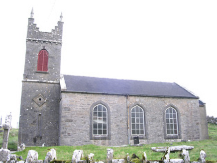 Saint Thomas's Church (Kilmactranny)Church/chapel · 694 yd
Explorer Tom Saint Thomas's Church in Carrickard has very strong opinions about modern buildings, mostly that they look like…
 Foyoges BridgeBridge · 1.8 mi
Explorer Tom Foyoges Bridge in Aughnacloy has a dramatic feud with the big tree next to it over who has better arches. The bridge…
 Loughbrick BayBay · 2.1 mi
Explorer Tom Loughbrick Bay in County Sligo would tell you after a few pints that it actually swallowed a boat once but gave it back…
 Barroe NorthMountain / peak · 2.5 mi
Explorer Tom Barroe North thinks it’s cooler than its famous neighbour, but honestly, who are we to judge? It’s got that mysterious…
 Ballindoon Castle (in Ruins)Castle, unclassified · 2.8 mi
Explorer Tom Ballindoon Castle sits on a steep slope where the ground drops eight metres straight into Lough Arrow. The shortcut…
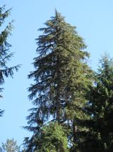 Western Hemlock2.9 mi
Explorer Tom Western Hemlock in County Roscommon holds a long grudge against the weather because it thinks the rain is personally…
 Giants GravePortal tomb · 2.9 mi
Explorer Tom Giants Grave in Carrickglass is the site of a ridiculous smuggling story involving cheese and a very large roofstone.…
 Bristlecone Fir2.9 mi
Explorer Tom Bristlecone Fir in County Roscommon is a weird one to have here since they usually live up in the high desert…
 Carn, StonePassage tomb · 4.3 mi
Explorer Tom Carn, Stone in Heapstown is having a massive feud with the rain because it refuses to let the moss grow on its southern…
 Ballinafad CastleCastle · 4.3 mi
Explorer Tom Ballinafad Castle guards the old Curlew Pass in County Sligo, with four round corner towers giving its square body the…
 Hog's IslandIslet · 4.7 mi
Explorer Tom Hog’s Island in County Roscommon sounds like the place where pigs go to hide from the butcher, but it’s probably just a…
 Battle of the Curlew Mountains (1599)Battlefield · 5.3 mi
Explorer Tom The Battle of the Curlew Mountains has a family tree consisting entirely of angry men with sticks and bad decisions.…
More archaeology and monuments in County Sligo · All of County Sligo

What do you know about this place?Tap to add a comment or ask a question