
What is recorded here
From the National Monuments Service (Archaeological Survey of Ireland) record MA039-032
Places near here
Photo credits
- Maker not stated on source page, uk.pinterest.com
- Maker not stated on source page, www.pinterest.com
- Maker not stated on source page, commons.wikimedia.org
- Maker not stated on source page, www.express.co.uk
- National Inventory of Architectural Heritage
- Maker not stated on source page, en.wikipedia.org
- Maker not stated on source page, tr.pinterest.com
- Maker not stated on source page, www.flickr.com
- Maker not stated on source page, ru.pinterest.com
- Connaught Telegraph; photographer not named, www.con-telegraph.ie
- David Farrell Photography / Western People, www.westernpeople.ie
 Coarse IslandCrannog · 335 yd
Explorer Tom Coarse Island claims it’s ancient but really just got stuck in the mud when the water went down. It’s now a scrubby…
 Inishlee IslandIslet · 824 yd
Explorer Tom Inishlee Island refuses to fall down because it’s too stubborn to admit it’s tired. It thinks gravity is just a…
 Burial ground in Inishlee IslandBurial ground · 911 yd
Explorer Tom Burial ground in Inishlee Island thinks the postman owes it money and hasn't forgiven him yet. The island is called…
 Children's burial ground in Inishlee IslandChildren's burial ground · 913 yd
Explorer Tom Children's burial ground in Inishlee Island is hiding a treasure that’s definitely just a rusty biscuit tin from 1974.…
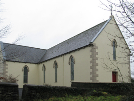 Saint Teresa's Catholic ChurchChurch/chapel · 1663 yd
Explorer Tom Saint Teresa's Catholic Church in Rathduff is evoking comparisons to Knockmore’s church because it clearly wanted to be…
 Castle KellyArchaeological place · 1724 yd
Explorer Tom Castle Kelly in County Mayo is an archaeological site that must have taken a ridiculous number of cups of tea to build.…
 CastleCastle, unclassified · 1.3 mi
Explorer Tom This castle in Newtown has plans for retirement involving becoming a very comfortable pile of rubble that nobody wants…
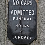 Cloghans CemeteryCemetery · 1.4 mi
Explorer Tom Cloghans Cemetery’s least favourite visitor is definitely anyone who brings a selfie stick into what should be a solemn…
 Kilbelfad Old GraveyardGraveyard · 1.5 mi
Explorer Tom Kilbelfad Old Graveyard in County Mayo would bring absolutely nothing to a party except a suspiciously quiet corner…
 Errew HouseCountry house · 2.5 mi
Explorer Tom Errew House in Errew bragged about surviving a storm that broke half the roof tiles off its neighbour. It was designed…
 Ardagh, Ardagh GAAGAA ground · 3.2 mi
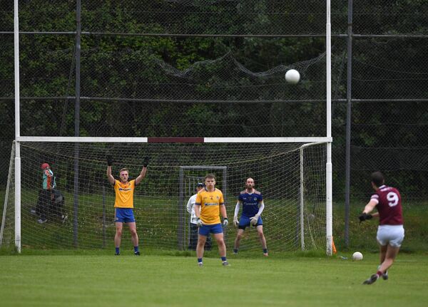 St. Tiernan's Park, Crossmolina Deel RoversGAA ground · 3.2 mi
More archaeology and monuments in County Mayo · All of County Mayo

What do you know about this place?Tap to add a comment or ask a question