
Places near here
Photo credits
- National Inventory of Architectural Heritage
- Duncan Grant, Wikimedia Commons · CC BY-SA 2.0
- Aiden Clarke, Wikimedia Commons · CC BY-SA 2.0
- Mike Searle, Wikimedia Commons · CC BY-SA 2.0
- Jon Sullivan, Wikimedia Commons · CC0
- Oliver Dixon, Geograph · CC BY-SA 2.0
- Wikimedia Commons contributor · CC BY 2.5
- Richard Webb, Geograph · CC BY-SA 2.0
- Neville Goodman, Wikimedia Commons · CC BY-SA 2.0
- Gillaween, Wikimedia Commons · CC BY-SA 4.0
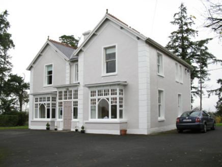 presbytery/parochial/curate's house1239 yd
Explorer Tom The Presbytery in Cashelduff would say it’s 'spiritually aligned' in a job interview, which basically means it’s a bit vague. It’s got those fancy bay windows that look like they’re eavesdropping. Bring a flask of something strong to cope with that.
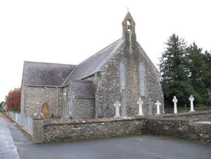 Saint James's Catholic ChurchChurch/chapel · 1329 yd
Explorer Tom Saint James’s Catholic Church would tell its younger self to stop trying so hard to look medieval and just be itself. It’s spent years polishing its sparrow-pecked surfaces, but it still looks a bit unsure of its own style. Give it a pat on the head from a distance.
 CashelFairy fort / stone ringfort · 5.3 mi
Explorer Tom Another cashel in Kilcashel stands tall on the ridge, looking down its nose at everyone else with its thick, sturdy drystone walls. The builder was definitely thinking about views when they stacked those rocks, ignoring the wind and the cold completely. Bring biscuits, every good story needs biscuits.
 ToberaraghtHoly well · 7.4 mi
Explorer Tom Toberaraght in Clogher has cursing stones cemented on top like very angry bookmarks. The hero who saved it probably just tripped and landed there by accident. Grand place for a sulk or a snog, entirely your call.
_-_geograph.org.uk_-_4073628.jpg/250px-Castles_of_Connacht,_Moygara,_Sligo_(1)_-_geograph.org.uk_-_4073628.jpg "Photo: Mike Searle, Wikimedia Commons · CC BY-SA 2.0") Moygara CastleCastle · 8.7 mi
Moygara CastleCastle · 8.7 miExplorer Tom Moygara Castle in County Sligo had a matchmaker working down the street who was so good at her job that everyone ended up married to the castle’s walls. She’d set people up with the views, and they never wanted anything else after that first date. Pretend you're a lost aristocrat, nobody will check.
_-_geograph.org.uk_-_4073636.jpg/250px-Castles_of_Connacht,_Moygara,_Sligo_(2)_-_geograph.org.uk_-_4073636.jpg "Photo: Mike Searle, Wikimedia Commons · CC BY-SA 2.0") Moygara Castle (in Ruins)Bawn · 8.7 mi
Moygara Castle (in Ruins)Bawn · 8.7 miExplorer Tom Moygara Castle has made a New Year’s resolution to stop leaning over so much and start standing straighter. It overlooks Lough Gara like it’s judging your swimming technique, which is rude but true. Bring wellies and low expectations, leave delighted.
 Caves of KeshCave · 12 mi
Explorer Tom Sixteen caves in one Sligo hillside? I would lose count halfway up and blame a ghost. The Caves of Kesh open across the west side of Keshcorran Hill, some chambers joining others inside pale limestone. Excavators found bones of brown bear, arctic lemming, Irish elk and wolf, an animal roll call that makes my own visitors look very tame. People also used the caves over many centuries, so the openings are part of a lived landscape as well as a geological one. I could make up a feast for every chamber, but the finds deserve better than my invented menu. The approach climbs steep ground and the caves are natural spaces, not a fitted visitor corridor; check access, weather and your footing. Carry a light if local guidance permits entry, and never push beyond your ability. From outside, the row of dark mouths already tells a fine story.
 Kesh CorannMountain / peak · 12 mi
Explorer Tom Kesh Corann in County Sligo is basically the uncle at the wedding who won't stop talking about his harpist ancestor. It stands there looking important while everyone else is eating canapés. Have a sandwich here and call it a heritage lunch.
 Curlew MountainsMountain / peak · 13 mi
Explorer Tom The Curlew Mountains may have nothing to do with curlew birds, which is awkward because I had prepared a terrific imitation. Their name likely grew from Irish words for rugged, pointed hills. Between Boyle and Castlebaldwin, hard sandstone and conglomerate rise above softer limestone country, giving this modest range its shape. The Battle of Curlew Pass took place here in 1599, a serious chapter that deserves a straight account. I would leave the bird call out of that story and use it only to annoy my travelling companion afterwards. Choose a lawful public trail or viewpoint, check local routes and weather, and treat any historic ground respectfully. Look at the ridgeline against the lower land. You can see why even these relatively low hills have long mattered.
 Lough Talt TrailVisitor information · 13 mi
Explorer Tom Lough Talt Trail has a shortcut that is technically longer if you count the time spent arguing about which way is down. The water supply up there is public, but the ego of this trail seems to be private property. Get there early and have it all to yourself.
 New Kilmorgan Burial GroundCemetery · 14 mi
Explorer Tom New Kilmorgan Burial Ground in County Sligo was built on a bargain involving three chickens and a promise. I’m pretty sure the chickens were just eggs, but whatever. Bring curiosity, leave with a better story than mine.
 The Mórrígan: OweynagatLegend location · 19 mi
Explorer Tom The Mórrígan: Oweynagat is called the Cave of Cats, which fooled me into expecting a very ordinary sort of trouble. Then the tale sends the Mórrígan out of it during the Táin. If the cats saw her coming, I bet they made room.
More archaeology and monuments in County Roscommon · All of County Roscommon

What do you know about this place?Tap to add a comment or ask a question