
Places near here
Photo credits
- National Inventory of Architectural Heritage
- Vanessa Kennedy, Wikimedia Commons · CC BY 2.0
- DeeEmm, Geograph · CC BY-SA 2.0
- Mike Searle, Geograph · CC BY-SA 2.0
- Dirk Huth, Wikimedia Commons · CC BY-SA 3.0
- Mike Searle, Wikimedia Commons · CC BY-SA 2.0
- Peter Allen, Wikimedia Commons · CC BY-SA 2.0
- Picture: Discover Ireland
Explorer Tom St. Bridgets Well has a statue that looks like it’s seen better days. Locals swear by superstitions here, which is nice. Stand still and listen, the wind tells it better than me.
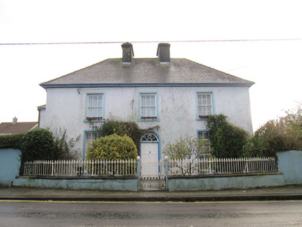 Saint Bride'sHouse · 619 yd
 Rock HouseHouse · 655 yd
Explorer Tom Rock House in Loughrea might be hiding contraband from a ridiculous smuggling story I made up. It’s got railings that look like they’re posing for a photo shoot. A handy spot to stretch your legs out wide.
 St. Brendans Catholic CathedralCathedral · 1062 yd
Explorer Tom St. Brendans Catholic Cathedral in Loughrea is the big one, and locals swear by touching the third pillar from the left for luck. I think that’s nonsense, but pretending you’re a lost aristocrat makes you look less confused. Pretend you're a lost aristocrat, nobody will check.
Bush IslandIslet · 1354 ydMiddle IslandIslet · 1389 yd Long PointHeadland · 1.2 mi
 Raruddy Castle (in ruins)Castle, tower house · 1.6 mi
Explorer Tom Raruddy Castle in Galway is a mystery wrapped in a bush. I bet after three pints, it’d spill every dark secret of the county. Have a look and decide if I was lying about the ghosts.
 Turoe StoneHeritage attraction · 3.5 mi
 Castle (in ruins)Castle, tower house · 4.7 mi
Explorer Tom Castle in Dunsandle is playing hide-and-seek with me. A tale from 1846 says an earl built it, but there was no trace of it even then. Bring someone who'll believe anything.
 Kilconnell AbbeyVisitor attraction · 11 mi
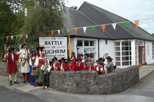 Battle of Aughrim Interpretative CentreMuseum · 12 mi
More archaeology and monuments in County Galway · All of County Galway

What do you know about this place?Tap to add a comment or ask a question