What is recorded here
From the National Monuments Service (Archaeological Survey of Ireland) record CL048-005001
The monument record does not grant public access. Check the route and ask the landowner before entering private land.
- What survives
- Recorded monument
Places near here
Photo credits
- National Inventory of Architectural Heritage
- David Purchase, Geograph · CC BY-SA 2.0
- Roger Diel, Geograph · CC BY-SA 2.0
- Charles W Glynn, Geograph · CC BY-SA 2.0
- Simon Huguet, Wikimedia Commons · CC BY-SA 2.0
- Eddylandzaat, Wikimedia Commons · CC BY 3.0
- Richard cattel, Geograph · CC BY-SA 2.0
- GenesisNZ, Wikimedia Commons · CC BY-SA 4.0
- Chris, Geograph · CC BY-SA 2.0
- Gordon Hatton, Geograph · CC BY-SA 2.0
- Charles W Glynn, Wikimedia Commons · CC BY-SA 2.0
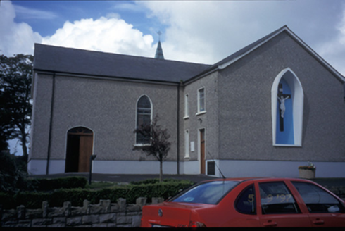 Catholic Church of Saint Michael the ArchangelChurch/chapel · 2.4 mi
Explorer Tom Kilmihil’s Saint Michael the Archangel dates to 1834 and boasts galleries in its transepts alongside a renovated organ loft and marble reredos.
 Saint Mary's Catholic ChurchChurch/chapel · 3.5 mi
Explorer Tom Inside Saint Mary's Catholic Church in Creegh South, you'll find exposed painted roof timbers and a carved white marble reredos that dazzle the eye.
 Tromra CastleCastle, tower house · 6.2 mi
Explorer Tom Tromra Castle stands proudly on level marshy ground, keeping a close, curious eye on the distant Mutton Island to the northwest.
 Doughmore BeachBeach / strand · 6.4 mi
Explorer Tom Doughmore Beach offers great surf but shifting sands, so keep an eye out if you’re brave enough to paddle.
 Emlagh PointHeadland · 6.7 mi
Explorer Tom Emlagh Point is a headland in County Clare, perhaps offering a panoramic view of the bay and the western coastline ahead.
 SlievecallanMountain / peak · 6.8 mi
Explorer Tom Slievecallan, a mountain that’s as rugged as the winter landscape it’s dressed in during January.
 Seafield North BeachBeach / strand · 6.9 mi
Explorer Tom Seafield North Beach gives views of Seafield harbour and Mutton Island in the distance, perfect for a wander.
 Spanish Point BeachBeach / strand · 6.9 mi
Explorer Tom Spanish Point Beach is an extensive sandy stretch west of Milltown Malbay, though you’ll need to watch the bye-laws.
 Caherrush Castle (in Ruins)Castle, tower house · 7.2 mi
Explorer Tom Caherrush Castle sits quietly near Spanish Point, and you must check with the landowner before stepping onto this private tower house.
 Spanish PointVisitor information · 7.2 mi
Explorer Tom Spanish Point has me wondering if it's a place where the Spanish Armada once landed; the account doesn't say what's special about it.
 Lurga PointHeadland · 7.2 mi
Explorer Tom Lurga Point stretches boldly toward Mutton Island, where the rocky reef meets the ocean in a splashy, wild embrace.
 Mutton IslandIsland · 8.4 mi
Explorer Tom Mutton Island! A small island with a name that sounds like it could be part of a royal lineage, what secrets does it keep in County Clare?
More archaeology and monuments in County Clare · All of County Clare
What do you know about this place?