
Places near here
Photo credits
- P.hammer, Wikimedia Commons · CC BY-SA 3.0
- National Inventory of Architectural Heritage
- The Banner, Wikimedia Commons · CC BY-SA 3.0
- No machine-readable author provided. Bogman assumed (based on copyright claims)., Wikimedia Commons · CC BY-SA 2.5
- Andy Waddington, Wikimedia Commons · CC BY-SA 2.0
- The original uploader was Rwxrwxrwx at English Wikipedia ., Wikimedia Commons · CC BY-SA 3.0
- Bob Jones, Geograph · CC BY-SA 2.0
- Gordon Hatton, Geograph · CC BY-SA 2.0
Explorer Tom Enclosure in Cahermaclanchy claims it took exactly forty-two cups of tea to build this oval shape, which is either…
Doolin Cave Visitor CentreHeritage attraction · 1578 ydExplorer Tom Doolin Cave Visitor Centre is absolutely screaming for attention on its social media feed, posting selfies it took with…
 Doolin CaveCave · 1580 yd
Explorer Tom Doolin Cave has a great stalactite that makes the rest of my tall tales look undersized. Cavers J. M. Dickenson and…
Aran View SwalletCave · 1.2 miExplorer Tom Aran View Swallet has a story about a poet who fell into the ditch nearby and wrote a sonnet about mud. It’s the only…
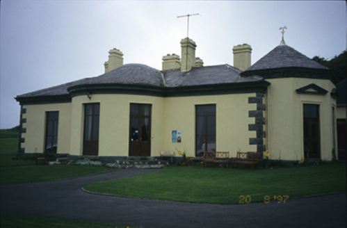 Ballinalacken CastleHouse · 1.2 mi
Explorer Tom Ballinalacken Castle in Ballynalackan is playing dress-up, swapping castle vibes for hotel chic with its new wing. It…
The BurrenHeritage attraction · 1.2 miExplorer Tom The Burren is a stone desert that thinks it's sophisticated because it grows orchids in the cracks and pretends it…
 Catholic Church of the Holy RosaryChurch/chapel · 1.2 mi
Explorer Tom Holy Rosary Church started because two lads bet five pence that they could build it before the rain stopped, and they…
 Court tomb in TeergoneanCourt tomb · 1.4 mi
Explorer Tom Court tomb in Teergonean has two chambers and zero chill, sitting in that limestone hollow like it’s judging your…
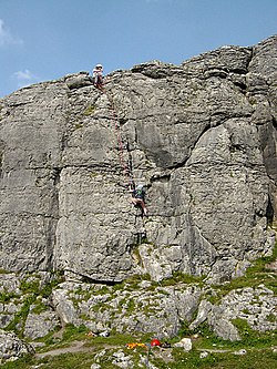 BallyryanCliff · 1.6 mi
Explorer Tom Ballyryan is the Burren crag that seems to have wandered up beside the coast road to show the bigger cliffs how to…
 AilladieCliff · 1.9 mi
Explorer Tom Ailladie is eight hundred metres of Clare limestone that makes climbers grin and makes me check where my feet are. The…
 Wild Atlantic Way: Doolin PierVisitor information · 2.5 mi
Explorer Tom Wild Atlantic Way Doolin Pier was once ruled by a goat who wore a tiny crown made of bottle caps and demanded tribute…
 Crab IslandIslet · 2.7 mi
Explorer Tom Crab Island in County Clare was run by a matchmaker who paired off lonely sailors with equally lost shepherds with…
More archaeology and monuments in County Clare · All of County Clare

What do you know about this place?Tap to add a comment or ask a question