Places near here
Photo credits
- National Inventory of Architectural Heritage
- Mike Searle, Wikimedia Commons · CC BY-SA 2.0
- Gordon Hatton, Geograph · CC BY-SA 2.0
- Kmcnamee, Wikimedia Commons · CC BY-SA 4.0
- SlaineMacRoth, Wikimedia Commons · CC BY-SA 4.0
- Mike Searle, Geograph · CC BY-SA 2.0
- N Chadwick, Wikimedia Commons · CC BY-SA 2.0
- Marathon, Wikimedia Commons · CC BY-SA 2.0
 school1077 yd
Explorer Tom School in Glebe is a rare Sunday school from the 1800s. It looks like it’s ready to teach you a lesson or two. Toast it…
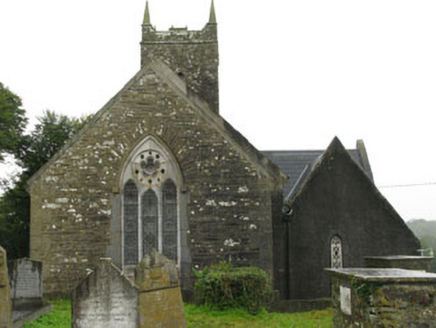 Christ ChurchChurch/chapel · 1145 yd
Explorer Tom Christ Church in Glebe has a plan so weird it makes my head spin. The limestone carvings are fancy, but I think the…
_-_geograph.org.uk_-_3036684.jpg/250px-Castles_of_Munster,_Ballinvard,_Cork_(1)_-_geograph.org.uk_-_3036684.jpg "Photo: Mike Searle, Wikimedia Commons · CC BY-SA 2.0") Ballinvard CastleCastle · 1722 yd
Ballinvard CastleCastle · 1722 ydExplorer Tom Ballinvard Castle in County Cork is just there, recorded as a castle with no extra fluff. I'm guessing it's standing…
 Castle (in Ruins)Castle, tower house · 1722 yd
Explorer Tom This Castle in Ballinvard stands on bedrock surrounded by higher ground, which means it’s always looking up at things…
 Rossmore, Kilmeen/KilbreeGAA ground · 1.1 miCorran HillMountain / peak · 1.6 mi
Explorer Tom Corran Hill hides a message in its stones if you squint hard enough, mostly because someone carved 'I was here' in 1890…
 Sheela-na-gig in Ballynacarriga (carbery East (eastern Div.) By.)Sheela-na-gig · 2.5 mi
Explorer Tom Sheela-na-gig in Ballynacarriga By.) is carved right above the castle door, flashing her bits to ward off evil, which…
Bunanumera, Randal ÓgGAA ground · 2.5 mi Fort RobertArchaeological place · 3.6 mi
Explorer Tom Fort Robert is an archaeological site where a prophecy said a dragon would land here in 1994, but it never did and…
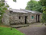 Michael Collins BirthplaceHistoric birthplace · 4.7 mi
Explorer Tom Michael Collins’s birthplace was burned by the British, which is a bit dramatic for a humble home. It took about two…
 Battle of the Big Cross (1798) Memorial MonumentMonument · 5.2 mi
Explorer Tom Battle of the Big Cross (1798) Memorial Monument in County Cork is standing there looking all dignified, but I swear…
 Michael Collins House MuseumMuseum · 5.9 mi
Explorer Tom Michael Collins House sits at number 7 Emmet Square in Clonakilty, ready to give the Big Fella more than a statue and a…
More archaeology and monuments in County Cork · All of County Cork

What do you know about this place?Tap to add a comment or ask a question