What is recorded here
In rough grazing, on a terrace on the lower S-facing slopes of Cahernageeha Mountain and overlooking Derrynane Bay to the SW. A circular enclosed area (diam. c. 30m) is indicated on the 1846 OS 6-inch map, while a roughly oval enclosed area (c. 27m N-S; c. 21m E-W), named 'Cealluragh Burial Gd.', is indicated on the…
Read the whole record
In rough grazing, on a terrace on the lower S-facing slopes of Cahernageeha Mountain and overlooking Derrynane Bay to the SW. A circular enclosed area (diam. c. 30m) is indicated on the 1846 OS 6-inch map, while a roughly oval enclosed area (c. 27m N-S; c. 21m E-W), named 'Cealluragh Burial Gd.', is indicated on the 1896 OS 6-inch map. A section of the original enclosing element (L c. 6m; T 1.35m; H 0.45m) is visible along the W arc. It consists of an inner and an outer row of large block-type stones with evidence of an infill of smaller stones. The enclosing element is unclear W-N due to damage and a dense cover of briars and ferns. Later, roughly built, slightly curving walls at E and at S may have come from the original enclosing element and from the surrounding stony fields. The interior is covered with dense overgrowth and was used as a children's burial ground (KE106-056005-). At least some of the stone grave-markers may also have come from the original enclosing element. Volume I: South-West Kerry' (Dublin: Stationery Office, 2009).
From the National Monuments Service (Archaeological Survey of Ireland) record KE106-056003
Places near here
Photo credits
- Nigel Cox, Geograph · CC BY-SA 2.0
- National Inventory of Architectural Heritage
- Eileen Henderson, Geograph · CC BY-SA 2.0
- DavidBosonnet, Wikimedia Commons · CC BY-SA 4.0
- Rossographer, Geograph · CC BY-SA 2.0
- Mike Searle, Geograph · Creative Commons Attribution-ShareAlike 2.0
- Dennis Turner, Wikimedia Commons · CC BY-SA 2.0
- Matthew Chadwick, Geograph · CC BY-SA 2.0
- Marathon, Geograph · CC BY-SA 2.0
- Sjunnesson, Wikimedia Commons · CC BY-SA 4.0
- Garry Dickinson, Geograph · CC BY-SA 2.0
 CaherdanielFairy fort / stone ringfort · 296 yd
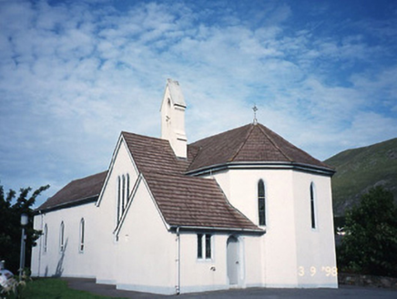 Saint Crohan's Catholic ChurchChurch/chapel · 679 yd
 Ogham StoneVisitor information · 1426 yd
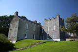 Derrynane House / Teach Dhoire FhionáinHeritage attraction · 1.2 mi
 Teach Dhoire Fhíonáin [Derrynane House]Country house · 1.2 mi
 Derrynane Beach / Trá Doire FhíonáinBeach / strand · 1.3 mi
 Burial GroundGraveyard · 1.8 mi
 Lamb's IslandIslet · 2.0 mi
 Abbey IslandMountain / peak · 2.0 mi
 Com An ChisteViewpoint · 2.5 mi
 Binn Uí RuaircMountain / peak · 2.7 mi
 Castle Cove (in Ruins)Castle, tower house · 3.0 mi
More archaeology and monuments in County Kerry · All of County Kerry

What do you know about this place?Tap to add a comment or ask a question