What is recorded here
In pasture, on lower N-facing slope of Caherbarnagh. Circular area (24.7m N-S; 23.9m E-W) enclosed by ruinous stone wall (H 1m; T 2.5m); break in wall to SSE (Wth 1.5m). Three quernstone fragments noted in wall. Vegetation pattern SW->N may indicate outer wall. Ruins of two subrectangular structures against inner face of wall to NE (L 5m) and S (L 2.9m). Possible Man-made underground passage (8970) E of centre.
From the National Monuments Service (Archaeological Survey of Ireland) record CO038-039001
The monument record does not grant public access. Check the route and ask the landowner before entering private land.
- What survives
- Recorded monument
Places near here
Fulacht FiadhFulacht fia · 378 ydFulacht FiadhFulacht fia · 768 yd Caherbarnagh nw TopMountain / peak · 1465 ydCaherbarnaghMountain / peak · 1.1 miChurch of Our Lady of LourdesChurch/chapel · 2.4 miDuncannon BridgeBridge · 2.7 miNohaval WoodWood · 3.7 miWildlife of the UplandsVisitor information · 4.2 miKilmeedy CastleCastle, tower house · 4.6 miRowan4.7 miMillstreet Museum & Tourist Information CentreMuseum · 4.8 miSt. Patrick's ChurchVisitor information · 4.9 mi
 Caherbarnagh nw TopMountain / peak · 1465 yd
 CaherbarnaghMountain / peak · 1.1 mi
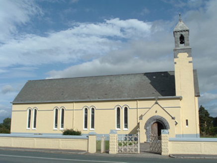 Church of Our Lady of LourdesChurch/chapel · 2.4 mi
 Duncannon BridgeBridge · 2.7 miNohaval WoodWood · 3.7 miWildlife of the UplandsVisitor information · 4.2 mi
 Kilmeedy CastleCastle, tower house · 4.6 mi
 Rowan4.7 miMillstreet Museum & Tourist Information CentreMuseum · 4.8 mi
 St. Patrick's ChurchVisitor information · 4.9 mi
Pictures: Colin Park, Geograph · CC BY-SA 2.0; National Inventory of Architectural Heritage; Jonathan Thacker, Geograph · CC BY-SA 2.0; Eeno11, Wikimedia Commons · CC BY-SA 3.0
More archaeology and monuments in County Cork · All of County Cork
What do you know about this place?