What is recorded here
Marked faintly as an oval feature (dims. c 40m E-W; c. 30m N-S) backing onto a road at S on the 1840 ed. of the OS 6-inch map. Situated in pasture at the SE-facing crest of a low hill, it is not visible at ground level.
From the National Monuments Service (Archaeological Survey of Ireland) record WA026-037
The monument record does not grant public access. Check the route and ask the landowner before entering private land.
- What survives
- Recorded monument
Places near here
Photo credits
- National Inventory of Architectural Heritage
- P L Chadwick, Geograph · CC BY-SA 2.0
- Tmimagery, Wikimedia Commons · CC BY-SA 4.0
- Paul O'Farrell, Geograph · CC BY-SA 2.0
- Brendan Tobin, Wikimedia Commons · CC BY-SA 4.0
- Kieran Campbell, Wikimedia Commons · CC BY-SA 2.0
- Philip Halling, Wikimedia Commons · CC BY-SA 2.0
- John M, Geograph · CC BY-SA 2.0
- Philip Halling, Geograph · CC BY-SA 2.0
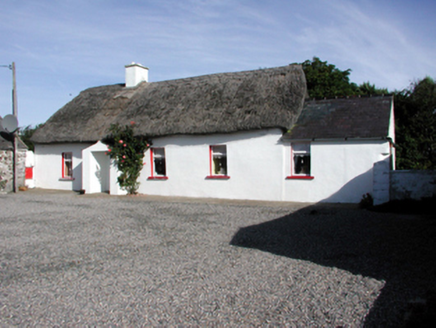 Historic buildingOfficially recorded historic building · 1295 yd
 Kilfarrasy BeachBeach / strand · 1.3 mi
 Metal Man TowerBeacon · 1.4 miThe Metal ManHeritage attraction · 1.4 mi
 Newtown CoveBeach / strand · 1.6 mi
 Fenor BogNature reserve · 1.9 mi
 Doneraile WalkWalking route · 2.2 mi
 Matthewstown Passage TombArchaeological place · 2.6 mi
 Dunhill CastleCastle · 2.8 mi
 Castle (in ruins)Castle, tower house · 2.8 mi
 Lime KilnVisitor information · 2.8 mi
 Tramore StrandBeach / strand · 3.6 mi
More archaeology and monuments in County Waterford · All of County Waterford
What do you know about this place?