
Places near here
Photo credits
- National Inventory of Architectural Heritage
- Newbert12, Wikimedia Commons · CC BY-SA 4.0
- Duncan Grant, Wikimedia Commons · CC BY-SA 2.0
- David Purchase, Geograph · Creative Commons Attribution-ShareAlike 2.0
- Richard Webb, Geograph · CC BY-SA 2.0
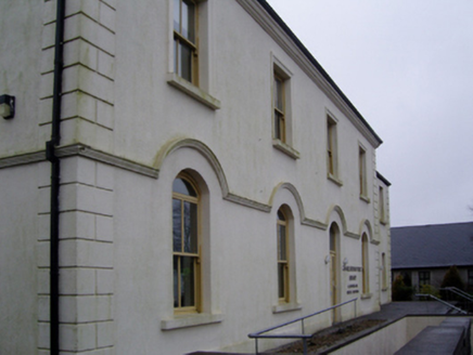 Charlestown Town Hall Arts CentreTown/county hall · 1.2 mi
Explorer Tom Charlestown Town Hall Arts Centre is exhausted by people asking if it's still a town hall. It’s been an arts centre for years, mate! Whisper a secret to its windows and see if the echo whispers back.
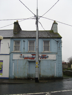 The Ideal BarHouse · 1.3 mi
Explorer Tom The Ideal Bar is where rabbits go to complain about the humans. It’s a dilapidated house with a fancy shopfront that’s seen better decades. Take a mate and argue about if it’s haunted or just tired.
 Saint James's Catholic ChurchChurch/chapel · 1.3 mi
Explorer Tom Saint James's Catholic Church in Lowpark was built by a man who loved cows and architecture equally. A cow once tried to buy it with a very shiny hoof, which is hilarious. Best visited with a curious mind and a strong stomach for gossip.
Old Cave Burial GroundArchaeological place · 4.5 mi CashelFairy fort / stone ringfort · 6.0 mi
Explorer Tom Another cashel in Kilcashel stands tall on the ridge, looking down its nose at everyone else with its thick, sturdy drystone walls. The builder was definitely thinking about views when they stacked those rocks, ignoring the wind and the cold completely. Bring biscuits, every good story needs biscuits.
East Mayo Brigade MonumentMemorial · 6.9 miBockagh HillMountain / peak · 7.0 miExplorer Tom Bockagh Hill bragged about surviving a storm so bad it made the clouds cry and quit their jobs for a while. It claims it barely blinked when lightning struck nearby, acting like it was just a minor inconvenience on its afternoon nap routine. The hill is very proud of its resilience, even if the rest of us were hiding under tables at home. Ideal spot for a dramatic phone call.
Rath Castle in ruinsCastle, tower house · 7.7 miExplorer Tom The Vikings got lost looking for Rath Castle and ended up building a pub instead, which explains the mess. It’s a tower house that’s more ruin than structure these days. Pick a stone, any stone, and invent its biography.
Castle (ruins)Castle, unclassified · 8.0 miExplorer Tom Castle in Glebe has a family tree that’s mostly made up of people who lost arguments. The Costellos held it for ages before handing the keys to someone who didn’t read the manual. Bring someone who'll believe anything.
 Grave YardGraveyard · 8.3 mi
Explorer Tom Graveyard in Aghamore would post a photo of its mossy headstones with the caption 'Living my best quiet life, #ancient'. It’s got that moody, atmospheric vibe going on that makes you feel instantly profound. Have a wander and a wonder.
Thorn CaveCave · 9.0 mi Lough Talt TrailVisitor information · 11 mi
Explorer Tom Lough Talt Trail has a shortcut that is technically longer if you count the time spent arguing about which way is down. The water supply up there is public, but the ego of this trail seems to be private property. Get there early and have it all to yourself.
More archaeology and monuments in County Mayo · All of County Mayo

What do you know about this place?Tap to add a comment or ask a question