Places near here
Photo credits
- Mike Searle, Wikimedia Commons · CC BY-SA 2.0
- National Inventory of Architectural Heritage
- Richard Webb, Geograph · CC BY-SA 2.0
- Jonathan Thacker, Geograph · CC BY-SA 2.0
- Darrin Antrobus, Wikimedia Commons · CC BY-SA 2.0
- A.-K. D., Wikimedia Commons · CC BY-SA 4.0
- A.-K. D., Wikimedia Commons · CC0
- Humphrey Bolton, Geograph · CC BY-SA 2.0
- kevin higgins, Wikimedia Commons · CC BY-SA 2.0
- Didier Descouens, Wikimedia Commons · CC BY-SA 4.0
_(geograph_5442502).jpg/250px-Castles_of_Leinster-_Adamstown,_Wexford_(1)_(geograph_5442502).jpg "Photo: Mike Searle, Wikimedia Commons · CC BY-SA 2.0") Castle (in ruins)Castle, tower house · 1.2 mi
Castle (in ruins)Castle, tower house · 1.2 miExplorer Tom Adamstown Castle is gone, which is great if you hate waiting for things to happen or finding parking in medieval times. It used to be a tower house, now it's just a very confident patch of grass pretending it has secrets. Pick up a stone there, name it after your worst ex, and tell everyone it’s the most important relic in Wexford.
 Saint Peter's Church (Adamstown)Graveyard/cemetery · 1.5 mi
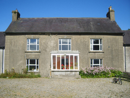 Adamstown HouseFarm house · 1.5 mi
 Carrickbyrne HillMountain / peak · 3.5 mi
 Taghmon CastleCastle · 7.4 mi
Explorer Tom Taghmon Castle swears it’s older than the first mention in 1548, which is a wild claim for a coastal spot! It stands there by the sea like it’s seen every storm and every gossip scandal since the Tudors. If it's closed, admire it from the road like a polite stalker.
 Battle of EnniscorthyBattle · 9.5 mi
 Font in Grange UpperFont · 19 mi
Explorer Tom Font in Grange Upper had an incident where a fox took charge of the area and declared itself king of the ruined church for three days straight. It’s just a crude granite box now, but it remembers the chaos of that furry tyrant ruling the roost with absolute authority. Take the long way round, it deserves the effort.
 Double lime kilnArchaeological place · 19 mi
 Tullaherin Church and Round TowerVisitor information · 20 mi
 Tullaherin Round TowerVisitor attraction · 20 mi
 Hawthorn23 mi
 St. Mogarra’s WellSpring · 25 mi
More archaeology and monuments in County Wexford · All of County Wexford

What do you know about this place?Tap to add a comment or ask a question