What is recorded here
On a rise in an undulating landscape. Circular grass-covered area (diam. 38m NNE-SSW; 35m WNW-ESE) defined by an earth and stone bank (Wth 3-4m; int. H 0.45-0.55m; ext. H 0.3-0.65m) with intermittently visible internal and external facing-stones. There is no visible fosse but there is an entrance at NNE. A relict field wall at SE may be the remains of an ancient overlying field system. Some small cairns in interior mark its use as a Children's Burial Ground (RO048-078002-). Rath (RO048-107----) is c. 70m to the S.
See the attached aerial view taken from the NW.
From the National Monuments Service (Archaeological Survey of Ireland) record RO048-078001
Places near here
Picture notes
- Graham Horn, Geograph · CC BY-SA 2.0
- National Inventory of Architectural Heritage
- Computer-made picture. It does not show this playground.
- Mike Searle, Geograph · CC BY-SA 2.0
 Sweathouse in EskerbaunSweathouse · 636 ydCurraghboy CastleCastle, unclassified · 1688 ydIndicatedFairy fort / stone ringfort · 1.0 mi
 Cam Church (in Ruins)Church · 1.2 mi
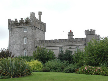 Moyvannan CastleCountry house · 3.2 miInchihicleleyIslet · 3.5 miInchnagowerIslet · 3.6 miSheep HillMountain / peak · 3.8 mi
 Children's playground3.9 miComputer-made picture. It does not show this playground.Carnagh BayBay · 4.5 miBally BayBay · 4.5 mi
 Cloonbigny CastleCastle, tower house · 5.7 mi
More archaeology and monuments in County Roscommon · All of County Roscommon
What do you know about this place?Tap to add a comment or ask a question