What is recorded here
Indicated as an irregularly shaped enclosure (max. dims. c. 54m) on the 1st (1839) ed. and as roughly pentagonal on the 1947 revision, with a field boundary running NE-SW along the edge of the NW sector, a field boundary running NE from the NE sector and another running roughly ENE from the SE sector. Only the NW-N-NE perimeter of the monument is retained in a field boundary, the remainder of the enclosure E-S-W has been levelled. The fosse (Wth c. 3m) is visible as a cropmark on satellite imagery (Google Earth, imagery date 25 April 2021)
KK023-065----_01 satellite imagery (Google Earth, imagery date 25 April 2021)
Compiled by: Jean Farrelly
Date of upload: 23 August 2021
Indicated as an irregularly shaped enclosure (max. dims. c. 54m) on the 1st (1839) ed. and as roughly pentagonal on the 1947 revision, with a field boundary running NE-SW along the edge of the NW sector, a field boundary running NE from the NE sector and another running roughly ENE from the SE sector. Only the NW-N-NE perimeter of the monument is retained in a field boundary, the remainder of the enclosure E-S-W…
From the National Monuments Service (Archaeological Survey of Ireland) record KK023-064
The monument record does not grant public access. Check the route and ask the landowner before entering private land.
- What survives
- Recorded monument
Places near here
Photo credits
- National Inventory of Architectural Heritage
- P L Chadwick, Geograph · CC BY-SA 2.0
- A.-K. D., Wikimedia Commons · CC BY-SA 4.0
- Algirdas at Lithuanian Wikipedia, Wikimedia Commons · Public domain
- kevin higgins, Geograph · CC BY-SA 2.0
- Humphrey Bolton, Geograph · CC BY-SA 2.0
 Desart CourtWalled garden · 1688 yd
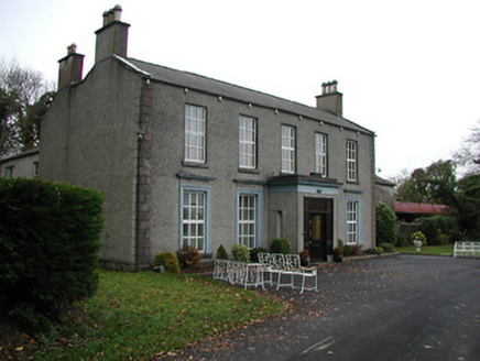 FarmleyCountry house · 1.0 mi
 Burnchurch CastleVisitor information · 1.5 mi
 Graveyard1.6 mi
 Ballybur CastleCastle, tower house · 1.9 mi
 Pedunculate Oak1.9 mi
 ToberakinHoly well · 1.9 mi
_Castle_from_entrance_side.jpg/250px-Newtown_(Shea)_Castle_from_entrance_side.jpg "Photo: A.-K. D., Wikimedia Commons · CC BY-SA 4.0") Castle (in ruins)Castle, tower house · 2.4 mi
Castle (in ruins)Castle, tower house · 2.4 mi Saint Brigid's WellSpring · 2.5 mi
 Millennium WoodWood · 3.0 mi
 Stop 7: Callan's Augustinian FriaryVisitor information · 3.1 mi
 Mill IslandIslet · 3.2 mi
More archaeology and monuments in County Kilkenny · All of County Kilkenny
What do you know about this place?