What is recorded here
From the National Monuments Service (Archaeological Survey of Ireland) record ME033-022001
Places near here
Photo credits
- Kieran Campbell, Geograph · Creative Commons Attribution-ShareAlike 2.0
- SeoR, Wikimedia Commons · CC BY-SA 4.0
- Kieran Campbell, Geograph · CC BY-SA 2.0
- C O'Flanagan, Geograph · CC BY-SA 2.0
- Alvesgaspar, Wikimedia Commons · CC BY-SA 3.0
 Garristown BridgeBridge · 1546 yd
Explorer Tom Garristown Bridge was built in 1880 by J.A. Dillon and crosses the river with a single arch. It’s got a date plaque, which I think is very important for its ego. Take a photo of the limestone cappings if you pass by!
 The story of the milk standMemorial · 1.1 mi
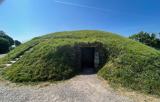 FourknocksPassage tomb · 1.2 mi
 IndicatedGraveyard · 1.6 mi
 Church (in Ruins)Church · 1.6 mi
 Passage tomb art in FourknocksPassage tomb art · 1.6 mi
 Westown HouseCastle, tower house · 2.9 mi
Explorer Tom Westown House incorporates parts of an earlier tower house and hall, blending medieval foundations into an eighteenth-century mansion.
 Seamus Ennis Cultural CentreMemorial · 3.1 mi
Explorer Tom The Seamus Ennis Cultural Centre in County Dublin opened in 2001 to celebrate a piper who knew his stuff. I bet the music inside is loud. Go get some tunes for me!
 Athcarne CastleCastle, tower house · 3.8 mi
 KnockbrackMountain / peak · 4.5 mi
Explorer Tom Knockbrack has a trig station on top for handy navigation. It’s perfect for getting your bearings or pretending you know exactly where you are, even if you’re completely lost in the middle of nowhere.
 Hollywood GreatMountain / peak · 4.9 mi
Explorer Tom Hollywood Great overlooks a church graveyard and Lambay Island in the distance. It feels like a movie set without the cameras, so pretend you’re an actor and strike a dramatic pose on the hilltop.
 Common Lime4.9 mi
More archaeology and monuments in County Meath · All of County Meath
What do you know about this place?Tap to add a comment or ask a question