What is recorded here
From the National Monuments Service (Archaeological Survey of Ireland) record MA107-008
Places near here
Photo credits
- Egbert Polski, Wikimedia Commons · CC BY-SA 4.0
- Keith Salvesen, Geograph · CC BY-SA 2.0
- Suzanne Mischyshyn, Geograph · CC BY-SA 2.0
- Colin Park, Geograph · CC BY-SA 2.0
- National Inventory of Architectural Heritage
- Richard Webb, Geograph · CC BY-SA 2.0
- Steve Edge, Wikimedia Commons · CC BY-SA 2.0
- Hello, I am Bruce on Flickr, Wikimedia Commons · CC BY-SA 2.0
- Maker not stated on source page, commons.wikimedia.org
 Sheefry BridgeBridge · 400 yd
Explorer Tom Sheefry Bridge in Tawnycrower is an early nineteenth-century beauty with limestone dressings that are so sharp they…
 Sheeffry PassMountain pass · 704 yd
Explorer Tom Sheeffry Pass is the kind of mountain road that makes you feel like an explorer even when you're just trying to find…
 Tawny RowerMountain / peak · 1.4 mi
Explorer Tom Tawny Rower in County Mayo is the kind of peak Saint Patrick would have looked at and said, 'Right then, this one needs…
 Tievnabinnia se TopMountain / peak · 1.6 mi
Explorer Tom Tievnabinnia SE Top is giving off major 'I peaked in the eighties' vibes. I reckon a local priest once lost a bet here…
 Glennacally BridgeBridge · 2.4 mi
Explorer Tom Glennacally Bridge was designed by Alexander Nimmo, who clearly loved a pointed arch profile because this one looks…
 Gowlan BridgeBridge · 2.4 mi
Explorer Tom Gowlan Bridge was designed by a guy whose name is impossible to spell correctly, which is fitting for Mayo. A poet fell…
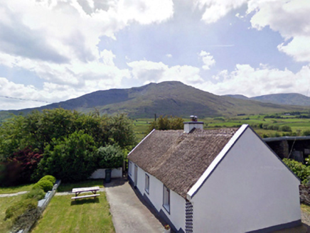 The Thatched CottageHouse · 2.6 mi
Explorer Tom The Thatched Cottage in Drummin East has a roof that needs more straw than sense. It’s built from fieldstone and…
 Erriff BridgeBridge · 2.7 mi
Explorer Tom Erriff Bridge in Aillebaun had a fox take charge of traffic last Tuesday, apparently. Designed by Alexander Nimmo in…
 Devilsmother Far North TopMountain / peak · 3.0 mi
Explorer Tom Devilsmother Far North Top thinks the road leading up to it is basically a personal insult to its dignity. It stands at…
 Aasleagh WaterfallWaterfall · 3.1 mi
Explorer Tom Aasleagh Waterfall is the kind of waterfall that pretends it’s not listening when you talk about your ex, but its…
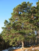 Scots Pine4.5 mi
Explorer Tom Scots Pine has a rivalry with a more famous place down the road that gets all the visitors and the photo ops. This one…
 Leenane GraveyardGraveyard · 4.6 mi
Explorer Tom Leenane Graveyard took about four hundred cups of tea to build, mostly because the mason kept stopping for a chat with…
More historic places in County Mayo · All of County Mayo

What do you know about this place?Tap to add a comment or ask a question