
Places near here
Photo credits
- National Inventory of Architectural Heritage
- Deemaykay, Wikimedia Commons · CC BY-SA 4.0
- Garry Dickinson, Geograph · CC BY-SA 2.0
- Algirdas at Lithuanian Wikipedia, Wikimedia Commons · Public domain
- Jean-Pol GRANDMONT, Wikimedia Commons · CC BY 3.0
- Mike Searle, Wikimedia Commons · CC BY-SA 2.0
- kevin higgins, Geograph · CC BY-SA 2.0
- Colin Park, Geograph · CC BY-SA 2.0
- N Chadwick, Geograph · CC BY-SA 2.0
- N Chadwick, Wikimedia Commons · CC BY-SA 2.0
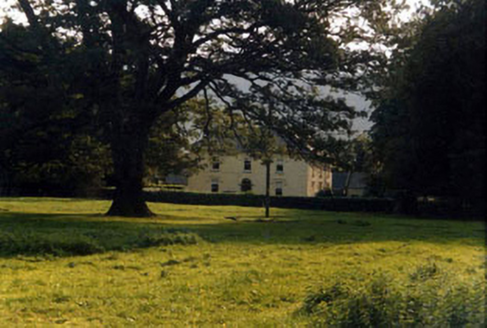 Ashgrove HouseHouse · 949 yd
Explorer Tom Ashgrove House inspired a really bad poem once that rhymed 'house' with 'mouse'. The owners have never quite forgiven the poet for that artistic choice. Bring a flask and pretend you own the place entirely.
 Ashgrove BridgeBridge · 1322 yd
Explorer Tom Ashgrove Bridge in Ardane has such a humpback it could be a retired sumo wrestler taking a nap. Those fancy cut stone arches are definitely designed to stop zombies climbing up, because who needs speed when you have gravity? Try not to trip over your own feet looking for the secret exit under there.
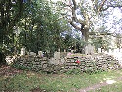 CrossCross, High cross · 1.2 mi
Explorer Tom Cross in Ardane is secretly proud of the potato growing right next to its base, which is very ironic for a holy site. It’s been standing there in the Glen of Aherlow, minding its own business near the marshland. Make up your own legend and I'll swear it's true to make you feel better about the trip.
 Bansha CastleCastle · 1.6 mi
Explorer Tom Bansha Castle is now a hotel, which means its unlikely celebrity friend is probably the guy who checked in last Tuesday and complained about the pillows. It was remodelled in 1835 with corner towers added to look fancy, like it’s trying too hard to impress. Stand on the spot and imagine the gossip it's heard.
 Pedunculate Oak1.9 mi
Explorer Tom Pedunculate Oak in County Tipperary would probably have 'Finally Rested' on its tombstone, because it has been standing here for so long that it is exhausted. It has seen things and endured weather that would make most people lose their minds completely by now. Tell it a joke, it's been a long time since anyone did.
 Tuliptree1.9 mi
Explorer Tom Tuliptree in Tipperary thinks tourists from Dublin are just overpriced sheep who think a park bench is a luxury item. It stands tall and ignores them, probably because it knows they’ll take ten selfies and then complain about the wifi speed. Have a sandwich here and call it a heritage lunch.
 Cappa Castle (in ruins)Castle, tower house · 1.9 mi
Explorer Tom Cappa Castle would tell its younger self to stop worrying about the wind and start enjoying the view from the ridge. It’s been planted with conifers now, looking like a very confused Christmas tree. Take a breath of that air, it's older than your car.
 FarbreagaMountain / peak · 3.7 mi
Explorer Tom This second Farbreaga hosted the biggest dance in history, but someone kicked the fiddle player into the mist so hard he never recovered. Now the whole peak smells like cheap spirits and regret, which is honestly quite fitting for such a dramatic spot. It’s the ideal location for making a very dramatic phone call to your ex.
 The RockViewpoint · 4.0 mi
Explorer Tom The Rock in County Tipperary is probably where the map makers got it wrong because they were too scared to draw a line that close to the edge. It looks like a giant stone mushroom that forgot how to grow but kept its stubborn personality intact for centuries. Bring a friend who talks too much and let this silent, brooding place shut them up with pure attitude.
 Christ the KingViewpoint · 4.3 mi
Explorer Tom Christ the King has a hidden treasure that is definitely just an old biscuit tin filled with broken buttons, but everyone pretends otherwise. It’s the ultimate test of your faith and your pocket change collection. Bring a camera and your most suspicious face.
 Glen of AherlowViewpoint · 4.4 mi
Explorer Tom Glen of Aherlow is where the seagulls hold their weekly meetings to complain about the weather. The view from here makes you question if your own life has enough drama. Whisper a secret at it, it's kept worse.
 GreenaneMountain / peak · 4.5 mi
Explorer Tom Greenane has an imaginary twin across the sea that it argues with every single day through the mist. They probably fight over whose shadow looks better on the horizon, which is just embarrassing for them both honestly. Take the long way round, because it definitely deserves the extra effort and the walk.
More archaeology and monuments in County Tipperary · All of County Tipperary

What do you know about this place?Tap to add a comment or ask a question