What is recorded here
In rough grazing land, immediately to N of farmyard. Circular area (diam. 31m) defined by earthen bank (H 1.4m). Interior planted with trees.
From the National Monuments Service (Archaeological Survey of Ireland) record CO061-159
Places near here
Photo credits
- National Inventory of Architectural Heritage
- Jonathan Thacker, Geograph · CC BY-SA 2.0
- Mike Searle, Wikimedia Commons · CC BY-SA 2.0
- Hywel Williams, Wikimedia Commons · CC BY-SA 2.0
- David P Howard, Geograph · CC BY-SA 2.0
 Holy well in CarhueHoly well · 928 yd
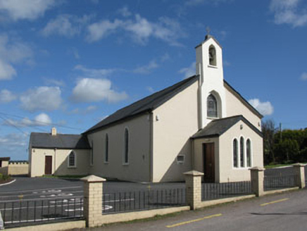 St Patrick's Roman Catholic ChurchChurch/chapel · 1.4 mi
 bridge1.4 miBallyvodane Castle (in Ruins)Castle, unclassified · 1.7 mi
Explorer Tom Ballyvodane Castle is fragmentary remains in a pasture, much of it bulldozed some years ago. Part of the north wall survives with a base batter. No trace of the south or west walls. It looks like a castle that got hit by a very small, very angry tractor.
Ballyanly Inniscarra Slí na SláinteWalking route · 2.4 mi New TipperaryVisitor information · 3.1 mi
 Carrignamuck Tower HouseCastle · 3.1 miOldcastle WoodWood · 3.4 miBob AdamsMemorial · 3.6 miSaint Bartholomew's WellSpring · 3.9 mi
.jpg/250px-St._Olan's_Well_-_geograph.org.uk_-_2832674_(cropped).jpg "Photo: Hywel Williams, Wikimedia Commons · CC BY-SA 2.0") St Olans WellHoly well · 4.8 mi
St Olans WellHoly well · 4.8 mi Farran WoodWood · 5.0 mi
More archaeology and monuments in County Cork · All of County Cork
What do you know about this place?Tap to add a comment or ask a question