
Places near here
Photo credits
- National Inventory of Architectural Heritage
- Liscannorman, Wikimedia Commons · CC BY-SA 3.0
- John M, Geograph · CC BY-SA 2.0
- Roger Diel, Geograph · CC BY-SA 2.0
- Joseph Mischyshyn, Geograph · CC BY-SA 2.0
- Frabjousone, Wikimedia Commons · CC BY-SA 4.0
- nick macneill, Geograph · CC BY-SA 2.0
- Gareth James, Geograph · CC BY-SA 2.0
- N Chadwick, Geograph · CC BY-SA 2.0
- Berthold Werner, Wikimedia Commons · CC BY-SA 4.0
 Birchfield HouseGates/railings/walls · 1300 yd
Explorer Tom Birchfield House in Teergonean has a New Year's resolution to stop crumbling into the mud by 2025. The gate lodge is ruins now, which is perfect for anyone who prefers their history with a side of moss. Bring a flask and pretend you own the place.
 Seamount HouseGate lodge · 1497 yd
Explorer Tom Seamount House in Cloghaundine is a gate lodge that thinks it’s a palace because of its fancy gates. A smuggler once hid a wheel of cheese behind the chimney stack, or so I hear. Bring a coin for luck and keep it in your pocket.
 St Bridgets WellHoly well · 1708 yd
Explorer Tom St Bridget’s Well in Ballysteen sits in a graveyard with a rectangular stone house, probably judging your outfit as you peek through the round-arched entrance. Ideal for a moody photo you'll pretend wasn't posed.
 Bridget's Well;St Bridget's WellSpring · 1711 yd
 O’Briens MonumentMonument · 1740 yd
Explorer Tom O’Briens Monument was erected by public subscription for Cornelius O'Brien, marking his twenty years as MP for the county.
 Liscannor Castle (in Ruins)Castle, tower house · 1.2 mi
Explorer Tom Liscannor Castle has a secret it’d spill after three pints, likely about which neighbour stole its flag in the 14th century. It’s charmingly dramatic, so sit on a wall near it and pretend you're in a painting.
 Cliffs of Moher Visitor CentreVisitor information · 1.8 mi
Explorer Tom Cliffs of Moher Visitor Centre is where the rugged beauty of County Clare comes alive
 O'Brien's TowerHeritage attraction · 2.0 mi
Explorer Tom O'Brien's Tower: a historic tower that stands as a symbol of strength and tradition
 Lahinch BeachBeach / strand · 2.1 mi
Explorer Tom Lahinch Beach lies near Lehinch, offering a classic Irish coastal scene that has captured many photographers’ hearts.
 Sea StackMountain / peak · 2.1 mi
Explorer Tom Sea Stack, a rocky outcrop in County Clare that’s as dramatic as the sea it overlooks.
 Castle (in ruins)Castle, tower house · 2.1 mi
Explorer Tom Castle in Dough is sitting on sand dunes next to a golf course. I bet the caddies used it as a locker room back in the day. Mind the nettles, because they are definitely the real guards here and they bite.
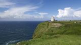 Cliffs of MoherCliff · 2.1 mi
Explorer Tom The Cliffs of Moher are basically the Atlantic Ocean's way of saying 'keep your distance'. Located at the southwestern edge of the Burren in County Clare, these bad boys stretch for about 14 kilometres. That is a lot of rock to fall off, so watch your step. At their southern end, they rise 120 metres above the water at Hag's Head. But eight kilometres north, near O'Brien's Tower, they hit a massive 214 metres. That tower was built in 1835 by Sir Cornelius O'Brien. Story goes he built it to watch his wife, but it looks more like a watchtower for giants. From the top, you can spot the Aran Islands in Galway Bay if the fog isn't being a nightmare. The Maumturks and Twelve Pins mountains sit to the north, and Loop Head is south. It’s a proper view, I'll give you that. With 1.5 million visitors a year, it’s packed, but the wind makes it feel like a ghost ship. You’ll see the sea crashing below, and you’ll feel very small. Which is good, because your ego is probably too big for this place anyway.
More archaeology and monuments in County Clare · All of County Clare

What do you know about this place?Tap to add a comment or ask a question