What is recorded here
Indicated is a twenty-metre circular enclosure in County Galway grassland, holding water in an outer ditch and hiding beneath trees rather than standing as a rugged fort. It likely belonged to Abbeyview House, serving as a decorative garden feature instead of a defensive stronghold. The clear boundary and flowing water suggest human design, while the missing history leaves the purpose wrapped in ambiguity.
In undulating grassland. Marked on 3rd ed. of OS 6-inch map (1948) as a circular area planted with trees (D c. 25m). It consists of a poorly preserved tree-covered circular enclosure (D 20m) defined by a scarp and external water-filled fosse, fed by a spring at SW and drained by a stream at S. Possibly a landscaped ringfort but more likely to be an ornamental feature associated with Abbeyview House, a 19th-C mansion 150m to NW.
The above description is derived from the published 'Archaeological Inventory of County Galway Vol. II - North Galway'. Compiled by Olive Alcock, Kathy de hÓra and Paul Gosling (Dublin: Stationery Office, 1999).
Date of upload: 05 August 2010
The monument record does not grant public access. Check the route and ask the landowner before entering private land.
- What survives
- Recorded monument
Places near here
 Quarry in Ballyglass (kilconnell By.)Quarry · 370 yd
 Lanferas WellHoly well · 486 yd
 Field system in AbbeyfieldField system · 495 yd
 Kilconnell AbbeyHeritage attraction · 525 yd
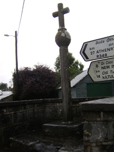 crosscross · 540 yd
 Castle (in Ruins)Castle, unclassified · 1.7 mi
 Ballynabanaba CastleCastle, tower house · 2.0 mi
 Large-leaved LimeLarge-leaved Lime · 2.6 mi
 Western RedcedarWestern Redcedar · 3.1 mi
 Battle of Aughrim Interpretative CentreMuseum · 4.3 mi
 Battle of AughrimMajor battlefield · 4.8 mi
 The bloody HollowHeritage attraction · 5.1 mi