What is recorded here
Situated on a fairly level landscape. The church (WX047-036----) is within a rectangular, grass-covered enclosure with some trees (dims 22m N-S; 21m E-W) defined by earthen banks (Wth c. 3m; int. H 0.5m; ext. H 0.8-1.4m) with entrances at W (Wth 1.2m) and S (Wth 1.85m). There is no indication of burial.
From the National Monuments Service (Archaeological Survey of Ireland) record WX047-036001
The monument record does not grant public access. Check the route and ask the landowner before entering private land.
- What survives
- Recorded monument
Places near here
Photo credits
- National Inventory of Architectural Heritage
- Cozzmick, Wikimedia Commons · CC BY-SA 4.0
- Mike Searle, Wikimedia Commons · CC BY-SA 2.0
- Sheila1988, Wikimedia Commons · CC BY-SA 4.0
- Yosemite, Wikimedia Commons · CC BY-SA 3.0
- Maker named on the Wikimedia Commons picture page · CC BY-SA 3.0
- David Hawgood, Wikimedia Commons · CC BY-SA 2.0
- Kenneth Allen, Geograph · CC BY-SA 2.0
 Silverspring HouseGates/railings/walls · 571 yd
 mill (wind)592 ydSt. Catherines WellHoly well · 1395 ydEnclosure in GraniskEnclosure · 1659 yd
 CastleCastle, tower house · 2.9 mi
_-_geograph.org.uk_-_3715787.jpg/250px-Castles_of_Leinster,_Ballyhealy,_Wexford_(1)_-_geograph.org.uk_-_3715787.jpg "Photo: Mike Searle, Wikimedia Commons · CC BY-SA 2.0") Castle (in ruins)Castle, tower house · 3.4 mi
Castle (in ruins)Castle, tower house · 3.4 mi Irish Agricultural MuseumMuseum · 3.9 mi
 Japanese cedar3.9 mi
 Dawn Redwood3.9 mi
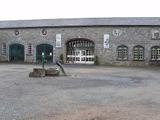 Johnstown CastleCastle · 4.0 mi
 Kilmore Quay - Crehen Twinning MemorialMemorial · 6.0 mi
 Kilmore Quay Walking TrailVisitor information · 6.2 mi
More archaeology and monuments in County Wexford · All of County Wexford
What do you know about this place?