What is recorded here
The fairy fort or earthen ringfort in Ballycrenode (Kilkeary parish) is in County Tipperary, Ireland. It stood on a gradual north-facing slope in gently undulating pasture, where quarrying damaged the interior before the whole site was levelled. Aerial photography from 1968 captured the resulting cropmark, preserving the memory of a 34.4 metre ring after the ground itself had been erased.
Situated on a gradual N-facing slope in gently undulating pasture. This site was levelled between 1963, when it was last inspected, and 1968 when it appears as a cropmark on an aerial photograph (CUCAP, AVN 58). The outline of the fosse is visible as a ring of differential grass growth (Wth 3m) giving a diam. of 34.4m for the site. In 1963 the site had already been severely damaged by quarrying in the interior. The surrounding bank (Wth 1.5m; ext. H 1.2-1.8m) and shallow outer fosse, however, were still relatively intact (OPW Correspondence, 1963).
The above description is derived from 'The Archaeological Inventory of County Tipperary. Vol. 1 - North Tipperary' compiled by Jean Farrelly and Caimin O'Brien (Dublin: Stationery Office, 2002). In certain instances the entries have been revised and updated in the light of recent research.
Date of upload/revision: 22 September 2008
The monument record does not grant public access. Check the route and ask the landowner before entering private land.
- What survives
- Recorded monument
Places near here
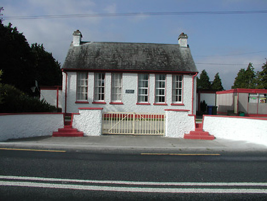 Kilkeary National Schoolschool · 1071 yd
 The Old Rectoryrectory/glebe/vicarage/curate's house · 1092 yd
 Millbrook Ho.Castle, unclassified · 1366 yd
 Enclosure in MillbrookEnclosure · 1520 yd
 LisheennaspiddogeFairy fort / ringfort · 1.1 mi
 LisnarahaCastle, ringwork · 1.5 mi
 Knockacraheen HillMountain / peak · 1.9 mi
 Gibbet HillMountain / peak · 1.9 mi
 Killavalla WoodForest · 2.6 mi
 Old BarracksHeritage attraction · 4.4 mi
 Sweet ChestnutSweet Chestnut · 4.5 mi
 Nenagh Heritage CentreMuseum · 4.5 mi