What is recorded here
Atop low hill, in area of dense scrub vegetation. Monument, depicted as circular enclosure (diam. c. 20m) on 1923 OS 6-inch map, is now completely covered by dense overgrowth.
From the National Monuments Service (Archaeological Survey of Ireland) record LI019-053
The monument record does not grant public access. Check the route and ask the landowner before entering private land.
- What survives
- Recorded monument
Places near here
Photo credits
- Mike Searle, Geograph · CC BY-SA 2.0
- National Inventory of Architectural Heritage
- Mike Searle, Wikimedia Commons · CC BY-SA 2.0
- Philip Halling, Geograph · CC BY-SA 2.0
- Wikimedia Commons contributor · Public domain
- Roger McLachlan, Wikimedia Commons · CC BY-SA 2.0
- N Chadwick, Geograph · CC BY-SA 2.0
Enclosure in CraggsEnclosure · 504 ydIndicatedFairy fort / earthen ringfort · 745 yd Ballyclogh HouseCountry house · 965 ydBallycullen HouseCountry house · 1.0 miDysert CastleCastle · 1.8 miDysert Castle (in ruins)Castle, tower house · 1.8 miAskeaton CastleHeritage attraction · 2.7 miHolly IslandIslet · 2.7 miFoynes Flying Boat & Maritime MuseumMuseum · 4.0 miGammarel PointHeadland · 4.0 miTummera LittleIslet · 4.0 miFoynes Island ViewpointViewpoint · 4.2 mi
 Ballyclogh HouseCountry house · 965 yd
 Ballycullen HouseCountry house · 1.0 mi
_-_geograph.org.uk_-_6276707.jpg/250px-Castles_of_Munster,_Dysert,_Limerick_(1)_-_geograph.org.uk_-_6276707.jpg "Photo: Mike Searle, Wikimedia Commons · CC BY-SA 2.0") Dysert CastleCastle · 1.8 mi
Dysert CastleCastle · 1.8 mi Dysert Castle (in ruins)Castle, tower house · 1.8 mi
 Askeaton CastleHeritage attraction · 2.7 miHolly IslandIslet · 2.7 mi
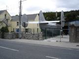 Foynes Flying Boat & Maritime MuseumMuseum · 4.0 miGammarel PointHeadland · 4.0 miTummera LittleIslet · 4.0 mi
 Foynes Island ViewpointViewpoint · 4.2 mi
More archaeology and monuments in County Limerick · All of County Limerick
What do you know about this place?