What is recorded here
At the N end of a broad pasture ridge with the ground falling steeply to the Clydagh River along the E. A roughly circular bivallate rath (int. diam. 30m) is bisected by a later field boundary wall running WNW-ESE across the interior. A broad inner bank (Wth. 4.2- 8.8m; int. H 0.25-1.4m; ext. H 1m-3m) is mainly…
Read the whole record
From the National Monuments Service (Archaeological Survey of Ireland) record MA070-101
Places near here
Photo credits
- National Inventory of Architectural Heritage
- Ken Ratcliff, Wikimedia Commons · CC BY 2.0
- Shanehahaha, Wikimedia Commons · CC BY-SA 3.0
- Pamela Norrington, Geograph · CC BY-SA 2.0
- Maker named on the Wikimedia Commons picture page · Public domain
- Liz McCabe, Geograph · CC BY-SA 2.0
- John D. Reigh, Wikimedia Commons · Public domain
- Eirambler, Wikimedia Commons · CC BY-SA 4.0
- P L Chadwick, Geograph · CC BY-SA 2.0
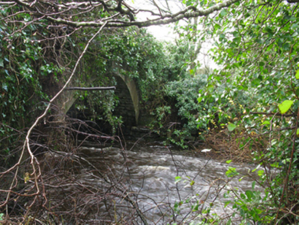 Park BridgeBridge · 1443 yd
Explorer Tom Park Bridge in Ballyguin has an arch that curves like a perfect smile. It’s got rock-faced skin and a very elegant attitude for a simple crossing. Pack a picnic and an excuse to sit nearby.
 bridge1.3 mi
 TowerRound tower · 1.5 mi
Explorer Tom Tower in Turlough is the only thing left from an early medieval monastery that probably smelled terrible. The shortcut up there isn't really a shortcut at all, trust me. Grand place for a sulk or a snog, your call.
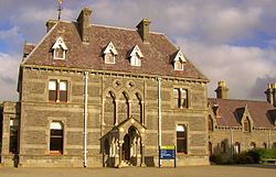 National Museum of Ireland, Country LifeMuseum · 1.8 mi
 Ballylahan Castle in RuinsCastle, Anglo-Norman masonry castle · 3.9 miBallylahan CastleCastle · 3.9 mi
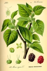 Black mulberry4.9 mi
Explorer Tom Black mulberry would use a lotto win to buy every single berry in County Mayo and eat them all at once. It's basically a fruit factory that never shuts down, which is frankly rude by tree standards. Look up, the best bit is always higher than you think.
 FarbreigaMountain / peak · 5.1 mi
 Battle of CastlebarMajor battlefield · 5.5 mi
 1798 MemorialMemorial · 5.8 mi
 Garden of RemembranceMemorial · 6.1 mi
 BurrenMountain / peak · 6.1 mi
More archaeology and monuments in County Mayo · All of County Mayo

What do you know about this place?Tap to add a comment or ask a question