What is recorded here
Associated with a fortified house (LF018-038----), which is located within the S half of the interior. The 1837 edition and the 1911–12 revision of the OS 6-inch map indicate that the bawn was divided into two by an internal E–W running wall that extended off the N wall of the house. A possible angle tower noted by…
Read the whole record
From the National Monuments Service (Archaeological Survey of Ireland) record LF018-038001
Places near here
Photo credits
- Maker not stated on source page, commons.wikimedia.org
- JP, Geograph · CC BY-SA 2.0
- Maker not stated on source page, tr.pinterest.com
- Royalcanalrunner, Wikimedia Commons · CC BY-SA 4.0
- Maker not stated on source page, www.pinterest.com
- Maker not stated on source page, www.neverstoptraveling.com
- National Inventory of Architectural Heritage
- Maker not stated on source page, www.findagrave.com
 CastleHouse, fortified house · 9 yd
Explorer Tom Castle in Ballinamore has a long list of former names that are all equally boring. Richard Browne built it to impress…
 Lyneen BridgeBridge · 414 yd
Explorer Tom Lyneen Bridge is straddling the water with the confidence of someone who knows they’re built by John Killaly. It’s all…
 Fairy fort / earthen ringfort in LyneenFairy fort / earthen ringfort · 815 yd
Explorer Tom Fairy fort / earthen ringfort in Lyneen is invisible, which means the Vikings got lost looking for it and went home…
 42nd LockLock · 1109 yd
Explorer Tom The 42nd Lock in Ards has been hiding a scandal for centuries, mostly involving who broke the gate first. It’s all…
 bridge1178 yd
Explorer Tom Bridge in Lyneen is the only unnamed original bridge on the Royal Canal, which makes it feel like a mysterious stranger…
 Fairy fort / earthen ringfort in Carrigeen (moydow By., Moydow Ed)Fairy fort / earthen ringfort · 1384 yd
Explorer Tom Carrigeen’s fort refuses to fall down because it’s too stubborn to admit it’s gone. It’s just a muddy circle pretending…
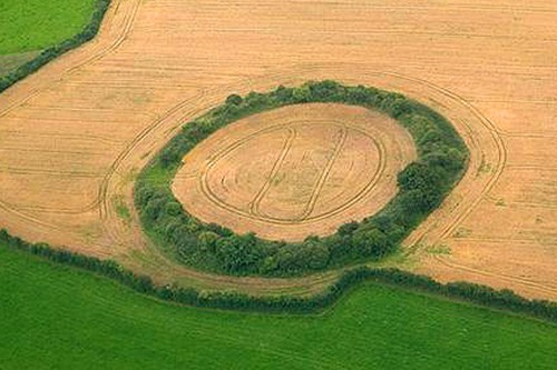 Fairy fort / earthen ringfort in BrickeensFairy fort / earthen ringfort · 1448 yd
Explorer Tom Fairy fort in Brickeens suspects the postman is actually a fairy scout sent to check if anyone still lives inside its…
 Ards BridgeBridge · 1514 yd
Explorer Tom Ards Bridge in County Longford has a secret talent: it can hold the weight of your ego while you cross it. It’s all…
Fairy fort / earthen ringfort in DerryoghilFairy fort / earthen ringfort · 1.1 miExplorer Tom Fairy fort / earthen ringfort in Derryoghil hides a treasure that is definitely just a rusty biscuit tin buried under…
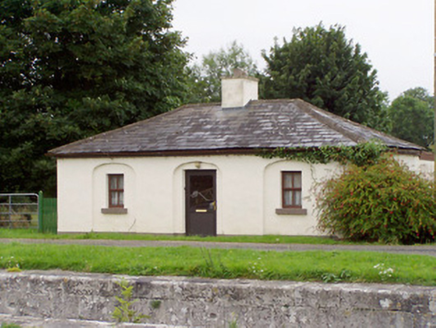 43rd LockLock keeper's house · 1.9 mi
Explorer Tom 43rd Lock in Aghnaskea once hosted a dramatic argument between two ducks over a single lock key. The keeper’s house has…
 Saint Patrick's Catholic ChurchChurch/chapel · 1.9 mi
Explorer Tom Saint Patrick's Catholic Church writes 'looking for someone who appreciates bare minimum Gothic Revival' on its dating…
 Mapped graveyardGraveyard · 2.1 mi
Explorer Tom Mapped graveyard in County Longford makes a weird creaking sound at night that locals swear is just the wind. It sounds…
More castles and forts in County Longford · All of County Longford

What do you know about this place?Tap to add a comment or ask a question