
Places near here
Photo credits
- Maker not stated on source page, en.m.wikipedia.org
- Maker not stated on source page, commons.wikimedia.org
- Maker not stated on source page, www.dreamstime.com
- National Inventory of Architectural Heritage
- Colin Park, Geograph · CC BY-SA 2.0
- N Chadwick, Wikimedia Commons · CC BY-SA 2.0
- Maker not stated on source page, www.gettyimages.ca
- Gordon Hatton, Geograph · CC BY-SA 2.0
- Joseph Mischyshyn, Geograph · CC BY-SA 2.0
- Kmcnamee, Wikimedia Commons · CC BY-SA 4.0
- Roger Diel, Geograph · CC BY-SA 2.0
 Enclosure in CahersherkinEnclosure · 1.5 mi
Explorer Tom Enclosure in Cahersherkin is playing hard to get on that pasture hill. I swear it’s just a giant mud pie waiting for…
 Fairy fort / earthen ringfort in BallybreenFairy fort / earthen ringfort · 1.5 mi
Explorer Tom Fairy fort / earthen ringfort in Ballybreen is basically a mud pie that forgot how to bake itself. It sits on a hill…
 Graveyard in KilcarraghGraveyard · 1.9 mi
Explorer Tom Graveyard in Kilcarragh only has one stone, so if you drop your phone there, that’s officially it for the whole place.…
 Kilcarragh Church (in ruins)Church · 1.9 mi
Explorer Tom Kilcarragh Church is largely collapsed, which means the dog that's in charge of it can finally sleep on the rubble…
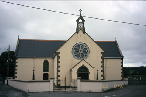 Saint Fachanan's Catholic ChurchChurch/chapel · 2.0 mi
Explorer Tom Saint Fachanan's Catholic Church in Kilcarragh has a rose window that looks like it’s winking at you, which is either…
 Burren Centre KilfenoraVisitor information · 2.0 mi
Explorer Tom The Burren Centre in Kilfenora is a sensible first stop before trying to make sense of north Clare's limestone hills. I…
 High CrossVisitor attraction · 2.0 mi
Explorer Tom High Cross was once offered for sale by a very confused cow who thought she could buy it with a bag of coins. She paid…
 TombTomb, effigial · 2.0 mi
Explorer Tom Tomb in Kilfenora was built on a bargain so shady even the devil would’ve asked for it in writing, probably involving a…
 Smithstown Castle (in ruins)Castle, tower house · 2.7 mi
Explorer Tom Smithstown Castle on a rocky outcrop is officially gone, but I swear it’s just napping. It thinks Dublin tourists are…
 Famine MemorialMemorial · 4.0 mi
Explorer Tom The Famine Memorial acts like it’s the guest at a wedding who stole the cake, standing there with its arms crossed in…
 Moy GAA pitchGAA ground · 6.0 mi
 Moy Castle (in Ruins)Castle, unclassified · 6.4 mi
Explorer Tom Moy Castle is playing hide-and-seek with me and winning big time, honestly it’s cheekier than most tourists I’ve met…
More archaeology and monuments in County Clare · All of County Clare

What do you know about this place?Tap to add a comment or ask a question