What is recorded here
Situated on the E slope of Badgerhill. A cairn described in the OS Letters as an 'oblong heap of loose quarry stones and earth thrown up from a deep trench or fosse at the south side of it. The ridge of the mound has the appearance of two low moates, one of them having been opened'. Known as St Colman's Chair (1941, 25-26). This may be the site that was shown as a closely dotted area on the 1843 OS 6-inch map. No visible surface trace.
Situated on the E slope of Badgerhill. A cairn described in the OS Letters as an 'oblong heap of loose quarry stones and earth thrown up from a deep trench or fosse at the south side of it. The ridge of the mound has the appearance of two low moates, one of them having been opened'. Known as St Colman's Chair (1941, 25-26). This may be the site that was shown as a closely dotted area on the 1843 OS 6-inch map. No…
From the National Monuments Service (Archaeological Survey of Ireland) record DU024A002
The monument record does not grant public access. Check the route and ask the landowner before entering private land.
- What survives
- Recorded monument
Places near here
Photo credits
- National Inventory of Architectural Heritage
- Bogman, Wikimedia Commons · CC BY-SA 3.0
- Colin Park, Geograph · CC BY-SA 2.0
- Mike Searle, Geograph · CC BY-SA 2.0
- Sitomon, Wikimedia Commons · CC BY-SA 2.0
- JP, Geograph · CC BY-SA 2.0
- Jonathan Billinger, Geograph · CC BY-SA 2.0
- 瑞丽江的河水, Wikimedia Commons · CC BY-SA 4.0
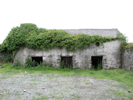 Johnstown HouseAnimal house · 693 yd
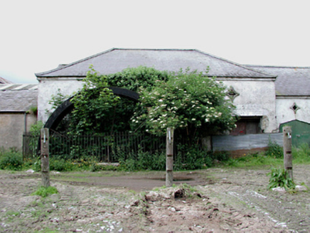 Johnstown HouseMill (water) · 715 ydKilteel WoodWood · 1.2 mi
 Kilteel CastleCastle, tower house · 1.4 mi
 Cupidstown HillMountain / peak · 1.9 miInniscara GalleryGallery · 2.6 mi
 CastleCastle, tower house · 3.2 mi
 European Yew3.4 mi
 Grand Canal WayWalking route · 4.7 mi
 Black HillMountain / peak · 5.1 mi
 Rath Turtle MoatFairy fort / ringfort · 5.3 mi
 Rath Turtle MoatArchaeological place · 5.3 mi
More archaeology and monuments in County Dublin · All of County Dublin
What do you know about this place?