What is recorded here
In rough grazing land. Circular area (diam. 44m) defined by scarp (H 1m), topped by stone wall. Interior planted with coniferous trees; possible Man-made underground passage (CO060-123002-) in NE quadrant.
From the National Monuments Service (Archaeological Survey of Ireland) record CO060-123001
Places near here
Photo credits
- National Inventory of Architectural Heritage
- Joebater at English Wikipedia, Wikimedia Commons · CC BY-SA 3.0
- Frederick Dean, Geograph · CC BY-SA 2.0
- Donald MacDonald, Geograph · CC BY-SA 2.0
- Corkonian2013, Wikimedia Commons · CC BY-SA 3.0
- Sole Origami, Wikimedia Commons · CC BY-SA 4.0
- Jo and Steve Turner, Geograph · CC BY-SA 2.0
- Maker named on the Wikimedia Commons picture page · CC BY-SA 2.5
- Hywel Williams, Wikimedia Commons · CC BY-SA 2.0
- Ceoil at English Wikipedia, Wikimedia Commons · CC BY-SA 3.0
- Michael Earnshaw, Geograph · CC BY-SA 2.0
 Historic buildingOfficially recorded historic building · 163 yd
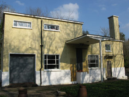 Rusheen CreameryCreamery · 179 yd
 Battle of MacroomBattle · 2.9 mi
 Mullinhassig WaterfallWaterfall · 3.0 mi
 Macroom Castle (in Ruins)Castle, tower house · 3.0 mi
 Mullinhassig WoodWood · 3.1 mi
 Carrigadrohid CastleHeritage attraction · 3.1 mi
 Carrigadrohid Castle (in Ruins)Castle, tower house · 3.2 mi
 Sessile Oak4.2 mi
.jpg/250px-St._Olan's_Well_-_geograph.org.uk_-_2832674_(cropped).jpg "Photo: Hywel Williams, Wikimedia Commons · CC BY-SA 2.0") St Olans WellHoly well · 4.3 mi
St Olans WellHoly well · 4.3 mi Carrigagulla Stone CircleArchaeological place · 4.7 mi
 MusheramoreMountain / peak · 6.4 mi
More archaeology and monuments in County Cork · All of County Cork

What do you know about this place?Tap to add a comment or ask a question