The deserted borough of Ardnurcher is located on a ridge about 500m north of the present village of Horseleap. The settlement was located in the fields labelled by Brownrigg in 1788 as 'high arable land' situated between the medieval church (
WM031-098----) (
WM031-098001-) and the Anglo-Norman motte and bailey castle (
WM031-099----). In the early 1170's, however, the cantred of Ardnurcher was granted to Meiler FitzHenry by Hugh de Lacy (Orpen 1892, 229). The manor was an important one and was defended from an early date. A settlement existed at Ardnurcher before the year 1200 when the Annals of Clonmacnoise recorded that ‘some of Meyler Bermingham’s people tooke the spoyle of the castle (WM031-099----) of Ardnurcher and burnt all the houses of the markett’ (Ann. Clon., 217). In 1213 the Annals recorded that ‘Cormack Mc Art O’Melaghlin tooke a great prey from the Towne of Ardnurcher, and the next morrow after tooke the spoyles of the castle of Ardnurcher, and market of the same, he tooke many other small preys and booties’ (Ann. Clon. , 226). The settlement had attained borough status by about 1235 when a burgage in Ardnurcher is mentioned in a charter of Walter de Lacy (Mac Niocaill 1977, 55). The Anglo-Norman settlers of Ardnurcher were often described in the Annals as the ‘Englishmen of Ardnurcher’ (Ann. Clon., 232). The settlement was in a frontier situation, and exposed to attacks from the native Irish such as that recorded in the Annals of Clonmacnoise for 1234 when Ardnurcher and Ballyloughloe (
WM030-047----) was burned by Fedlimid O Conchobhair, King of Connacht (Ann. Clon., 234). The motte and bailey castle (WM031-099----) stands on on the NE coner of the town walls of Ardnurcher. The deserted medieval settlement (
WM031-104----) was protected by a stone wall running along the base of the high esker ridge from the public road at N to NE which ran onto the defences of the motte and bailey castle at NE which was located at the SE end of the high esker ridge overlooking a stream and marshy area to the SE. A stone drawbridge which gave access from the settlement onto the bailey of the castle also acted as a gateway into the historic town of Ardnurcher from an old roadway which traversed the stream to the SE as shown on a plan of the castle dating from 1788. This gateway/drawbridge stands in the bottom of the enclosing fosse of the motte and bailey castle on the SW side of the motte. The wall footings of the town wall run southwards off the SW face of this drawbridge feature as depicted on the 1837 ed. OS 6-inch map. This wall (L. 130m) ran along the SE edge of the high ground overlooking the river valley to the SE. Today the grass-covered footings of the wall can be traced along the SE side of the deserted medieval settlement. The wall footings of two small square-shaped mural towers projecting outwards from the town wall on the SE as depicted on the 1837 ed. OS 6-inch map can be still be seen. The foundations of the town wall on the SE side terminates at a distance of about 160m from the motte, from which an earth and stone bank runs to the NW (Bradley et. al. 1985, 16). These earthen field banks are depicted on the 1837 ed. OS 6-inch map and they appear to post-date the town wall. There are no visible remains of the town wall from S to SW. On the W side of the church (WM031-098---) and graveyard are the remains of a stone structure (
WM031-105---) located 75m to the W of the church. This stone structure appears to be related to the town wall of Ardnurcher and may have been a gatehouse or stone building standing on the wall of the town. The grass-covered footings of the town wall and of a small square shaped mural tower (ext. dims. 6m NE-SW; Wall T 0.9m) can be seen 75m NW of this structure. This section of town wall on the W side of the deserted medieval settlement is 360m W of the drawbridge/gateway into the historic town of Ardnurcher. The town wall of Ardnurcher appears to encompass an irregular-shaped area measuring 360m from east to west. No surface remains of the town wall could be traced in the surrounding fields from W-N. Brownrigg's plan of the motte and bailey castle from 1788 shows clearly that the drawbridge also acted as a gateway into the motte and bailey castle from a roadway which crossed the stream to the SE. This roadway traversed the stream and before coming to the gateway divided into two sections, one of which leads directly into the motte and bailey castle and a second branch which turned W leading up the slope of the ridge and into the historic town of Ardnurcher (WM031-104----) from there onwards towards Ardnurcher church (WM031-098----) and graveyard. On the 1788 plan this roadway is shown running roughly SE-NW across the centre of the settlement of Ardnurcher and is annotated by Brownrigg as 'Ancient road from the Borders into the English Pale'.
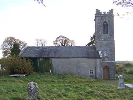 Horseleap Church (Ardnurcher or Horseleap)Church/chapel · 215 yd
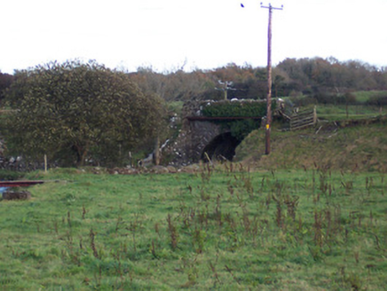 bridge321 yd
 Laragh CastleCastle · 2.1 mi
 Rosemount GAAGAA ground · 3.3 mi
 Durrow MoatCastle, motte · 5.4 mi
 CrossCross, High cross · 5.5 mi
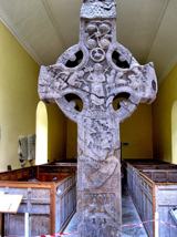 St. Columbkilles CrossCross, High cross · 5.5 mi
 Durrow High CrossVisitor attraction · 5.5 mi

What do you know about this place?Tap to add a comment or ask a question