
Places near here
Photo credits
- Mike Searle, Wikimedia Commons · CC BY-SA 2.0
- National Inventory of Architectural Heritage
- DeeEmm, Geograph · CC BY-SA 2.0
- Mike Searle, Wikimedia Commons · Creative Commons Attribution-ShareAlike 2.0
- Mac McCarron, Geograph · CC BY-SA 2.0
- Gordon Hatton, Geograph · Creative Commons Attribution-ShareAlike 2.0
- Mac McCarron, Geograph · Creative Commons Attribution-ShareAlike 2.0
- The original uploader was Rwxrwxrwx at English Wikipedia ., Wikimedia Commons · CC BY-SA 3.0
- Andy Waddington, Wikimedia Commons · CC BY-SA 2.0
- Graham Horn, Wikimedia Commons · CC BY-SA 2.0
- Kmcnamee, Wikimedia Commons · CC BY-SA 4.0
 Cahererillan CastleCastle · 1272 yd
Explorer Tom Caher Castle has been in a bitter feud with the rain since about 1650, and neither of them is willing to admit that…
 farm house1.7 mi
Explorer Tom Farm house in Loughcurra South would win the lotto and immediately buy a new roof because thatch is its nemesis. It…
 Castle in ruinsCastle, tower house · 1.8 mi
Explorer Tom Castle in ruins in Caherglassaun is playing hide-and-seek with me. The local sheep think it's a very fancy rock, but…
 Cappagh CastleCastle · 5.1 mi
Explorer Tom Cappagh Castle smells like wet stone and old secrets, according to my very reliable nose, which is probably just damp…
 Saint Kieran's Catholic ChurchChurch/chapel · 5.6 mi
Explorer Tom Saint Kieran’s Church has a tower that looks like it’s pointing at God to ask for help. The prophecy said a rainbow…
 Holy Well5.9 mi
Explorer Tom Holy Well in Glencolumbkille South is tiny, but it claims to cure your eyes and feet, which sounds like a very specific…
 Grave YardGraveyard · 6.0 mi
Explorer Tom Graveyard in Glencolumbkille South has a carved stone head hiding in the wall. Legend says if you don't wave, you get…
 AilladieCliff · 18 mi
Explorer Tom Ailladie is eight hundred metres of Clare limestone that makes climbers grin and makes me check where my feet are. The…
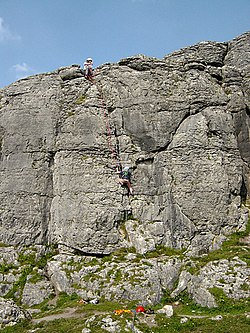 BallyryanCliff · 18 mi
Explorer Tom Ballyryan is the Burren crag that seems to have wandered up beside the coast road to show the bigger cliffs how to…
 An Trá MhórBeach / strand · 20 mi
Explorer Tom An Trá Mhór in County Galway would teach history by showing you how the tide erased every mistake people ever made on…
 Clg Micháel Breathnach GAA pitchGAA ground · 21 mi
 Coláiste CholmcilleSchool · 22 mi
Explorer Tom Coláiste Cholmcille claims its family tree is mostly made up of ancient architects who were also modernists. The…
More archaeology and monuments in County Galway · All of County Galway

What do you know about this place?Tap to add a comment or ask a question