
What is recorded here
Kildreenagh Burial Ground/Cill Draighneach or Ceallúnach an Lóthair: This site is located in rough pasture on the lower W slopes of Farraniaragh mountain, overlooking Ballinskelligs Bay. It is enclosed by a stone wall and contains an oratory, a leacht, three cross-inscribed slabs, a circular hut, and an area of…
Read the whole record
From the National Monuments Service (Archaeological Survey of Ireland) record KE106-007005
Places near here
Photo credits
- Maker not stated on source page, megalithics.com
- MollyCrilly, Wikimedia Commons · CC BY-SA 4.0
- Maker not stated on source page, uk.pinterest.com
- Maker not stated on source page, monumentalireland.ie
- Marathon, Geograph · CC BY-SA 2.0
- Sjunnesson, Wikimedia Commons · CC BY-SA 4.0
- Dennis Turner, Wikimedia Commons · CC BY-SA 2.0
- National Inventory of Architectural Heritage
- Maker not stated on source page, www.tripadvisor.com.au
- DavidBosonnet, Wikimedia Commons · CC BY-SA 4.0
- Eileen Henderson, Geograph · CC BY-SA 2.0
- Maker not stated on source page, tr.pinterest.com
 Megalithic structure in An LótharMegalithic structure · 164 yd
Explorer Tom Megalithic structure in An Lóthar is flexing its massive cup-marked block on Instagram. It claims to be a VIP tomb, but…
 Loher Stone FortArchaeological place · 342 yd
Explorer Tom Loher Stone Fort looks over Ballinskelligs Bay with the Farraniaragh Mountains behind it, a position so fine that even…
 Fairy fort / stone ringfort in An LótharFairy fort / stone ringfort · 551 yd
Explorer Tom Fairy fort / stone ringfort in An Lóthar bragged about surviving a storm that supposedly flattened every other roof…
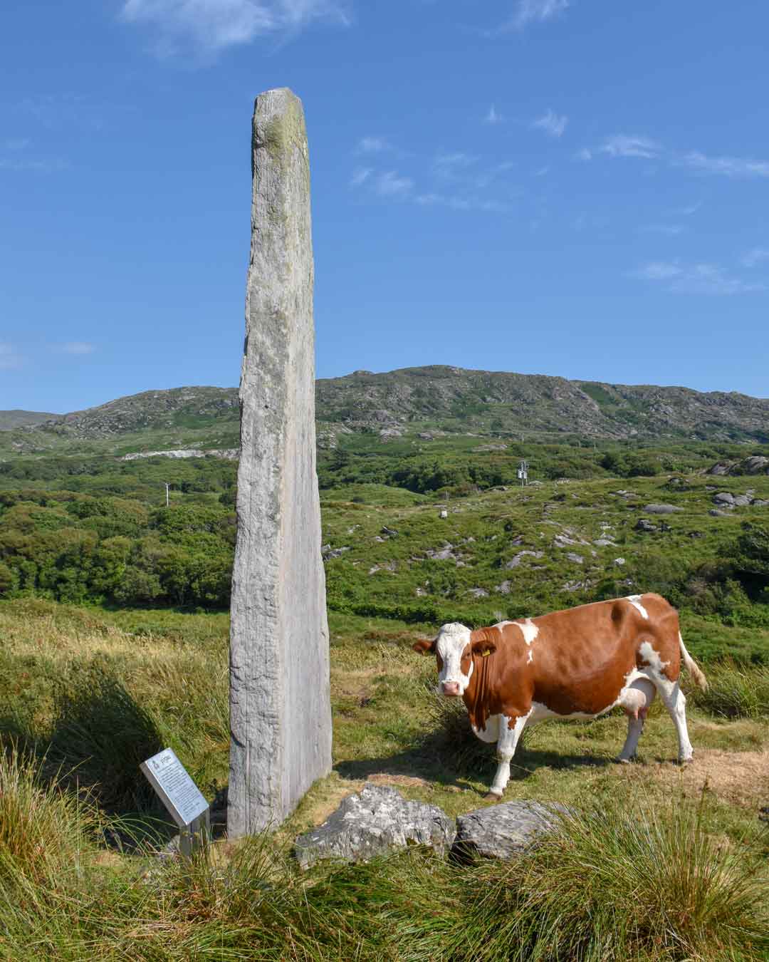 Ogham stone in An LótharOgham stone · 626 yd
Explorer Tom Ogham stone in An Lóthar holds a fake world record for being hard to find. It's been missing since O'Connell looked at…
 Com An ChisteViewpoint · 1402 yd
Explorer Tom Com An Chiste means 'The Hole of the Chest' in my expert opinion, which is likely completely wrong and deeply insulting…
 Binn Uí RuaircMountain / peak · 1410 yd
Explorer Tom Binn Uí Ruairc in County Kerry is hiding a treasure that is definitely just an empty biscuit tin from 1982. The legend…
 Lamb's IslandIslet · 1.9 mi
Explorer Tom Lamb's Island would file a complaint with the council about the sheer amount of tourist buses that honk at it without…
 Teach Dhoire Fhíonáin [Derrynane House]Gate lodge · 2.0 mi
Explorer Tom Derrynane’s gate lodge was where a priest once lost a bet involving a very expensive hat. It still looks smug about the…
 Derrynane AbbeyCountry house · 2.2 mi
Explorer Tom Derrynane Abbey got it wrong because O'Connell was too busy building wings to check the labels. The library wing is…
 Derrynane House / Teach Dhoire FhionáinHeritage attraction · 2.2 mi
Explorer Tom Derrynane House has a superstition that locals swear by: if you touch the wall three times, your luck improves slightly…
 Ogham StoneVisitor information · 2.3 mi
Explorer Tom Ogham Stone stands there near Derrynane House, covered in ancient scratches that locals swear will turn your hair green…
 Oileán na RónIsland · 2.3 mi
Explorer Tom Oileán na Rón has a family tree that is mostly made up by grandmothers who insisted their great-grandfather was a seal.…
More archaeology and monuments in County Kerry · All of County Kerry

What do you know about this place?Tap to add a comment or ask a question