Places near here
Photo credits
- Djedi Guy, Wikimedia Commons · CC BY-SA 4.0
- National Inventory of Architectural Heritage
- GTD Aquitaine, Wikimedia Commons · Public domain
- Andreas F. Borchert, Wikimedia Commons · CC BY-SA 4.0
- A.-K. D., Wikimedia Commons · CC0
- Willow, Wikimedia Commons · CC BY 2.5
- Maelor at English Wikipedia, Wikimedia Commons · Public domain
- David Perez, Wikimedia Commons · CC BY 3.0
- Bob Embleton, Wikimedia Commons · CC BY-SA 2.0
 Saint Brigid's Catholic ChurchChurch/chapel · 683 yd
Explorer Tom Saint Brigid's Catholic Church in Halfquarter probably polishes its stained glass windows when nobody is looking just to prove a point. It’s got round chimneys and crested tiles that make it look like it’s trying very hard to be fancy. Keep your eyes peeled for the community vibes here.
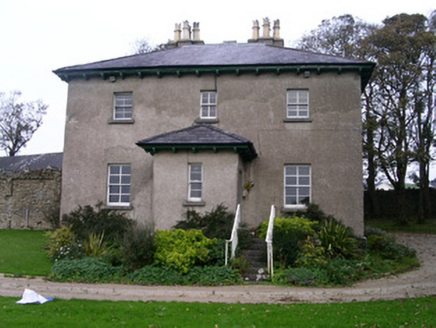 Rapids LodgeHouse · 1202 yd
Explorer Tom Rapids Lodge in Knockmuldoney swears that looking at the bay too long will turn your socks inside out. The house is symmetrical and smug about it, like a well-dressed cat. Look down from the high spot and check your socks just to be safe.
 Battle of CollooneyBattle · 2.1 mi
Explorer Tom The Battle of Collooney in County Sligo took about four cups of tea to build up the energy needed for the fighting, and they used them all up. Bartholomew Teeling put up a monument there, which is basically a giant finger wagged at history for forgetting this little scuffle. Stop the car, it's worth the hazard lights.
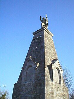
 Teeling MonumentMemorial · 2.1 mi
Explorer Tom The Teeling Monument refuses to fall down because it’s too proud to admit the ground beneath it is just soft mud. It stands there looking smug, like it owns the whole of Collooney and knows secrets it won’t share. Give it a pat on the way past, it's had a long life.
 Battlefield in Carricknagat (leyny By.),rinn (leyny By.),bleachgreen,collooney,ardcottenBattlefield · 2.1 mi
Explorer Tom Battlefield in Carricknagat survived a massive storm by just staying put, which is impressive for a spot with such a chaotic history of conflict and confusion. It’s got a real 'I’ve seen it all' attitude that makes you feel like your problems are tiny in comparison to the old wars. Go at sunset and thank me later.
 The Cailleach: CarrowmoreLegend location · 2.7 mi
Explorer Tom The Cailleach: Carrowmore is a field of ancient tombs with a woman in the stories powerful enough to shape the land around them. I can barely shift one big garden stone. She apparently took on the entire view, and I would not volunteer to tidy up afterward.
 CloghagadaideStone row · 2.8 mi
Explorer Tom Cloghagadaide is three stones in a row, one of which has clearly given up and flopped over. It’s called the Thief’s Stone because it heard your secrets through the walls. Go in good boots and better humour.
 European ash3.2 mi
Explorer Tom European ash in County Sligo was nearly sold as a horse because a farmer mistook its shape for a mane. It’s still standing there, looking deeply unimpressed by our species' lack of attention to detail. Take a breath of that air, it's older than your car.
 Miosgan MevaPassage tomb · 3.7 mi
Explorer Tom Miosgan Meva is the big brother on Knocknarea, sitting there like a giant stone bread loaf that nobody wants to eat. Its plan for retirement is to sit exactly where it is and let tourists trip over themselves trying to take photos. It’s got a flat top that looks like it was made for sunbathing by ancient kings. Bring the dog, it'll have opinions.
Queen Medb's Cairn: KnocknareaLegend location · 3.7 miExplorer Tom Queen Medb's Cairn: Knocknarea sits high on the mountain, and legend gives it a queen for an occupant. It is an enormous cairn. Whoever first tied Medb to it clearly had no interest in a modest ending to her story.
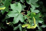 Field Maple3.8 mi
Explorer Tom Field Maple in County Sligo is cursed so that if you don't wave when passing, your left shoe falls off. It’s not magic, just bad luck with excellent timing. It's the kind of place that makes a dull Tuesday interesting.
 Tobernalt Holy WellSpring · 4.0 mi
Explorer Tom Tobernalt Holy Well would complain to the council that people keep leaving old bread on its head. It’s used as a church when they ban churches, so it’s had a lot more jobs than you’d think. Hang around long enough and you'll hear a story from a local.
More archaeology and monuments in County Sligo · All of County Sligo

What do you know about this place?Tap to add a comment or ask a question