What is recorded here
Situated on the N side of Inchmore Island on Lough Ree. A monastery was reputedly founded here by St. Laobhán (Ó Riain 2011, 390-1). He was one of 47 children whose mother was Cuman daughter of Dallbhrónach, maternal aunt to Saint Brighid of Kildare, whose was womb had been blessed by St. Patrick (ibid.). His feastday…
Read the whole record
From the National Monuments Service (Archaeological Survey of Ireland) record WM015-011
Places near here
Photo credits
- Picture: Heritage in Schools
- Maker not stated on source page, ru.pinterest.com
- National Inventory of Architectural Heritage
- David Baird, Wikimedia Commons · CC BY-SA 2.0
- Christopher Hilton, Wikimedia Commons · CC BY-SA 2.0
- Maker not stated on source page, en.wikipedia.org
- Kieran Campbell, Geograph · CC BY-SA 2.0
- Arno-nl, Wikimedia Commons · CC BY-SA 4.0
 Portlick Millennium ForestWood · 1.5 mi
Explorer Tom Portlick Millennium Forest has the sort of name that sounds as though somebody planted a thousand trees at midnight and…
 Portlick CastleCastle, tower house · 1.6 mi
Explorer Tom Portlick Castle on Lough Ree was nearly sold for a horse in one of my stories, which might be true if you squint. It’s…
 GlebeRectory/glebe/vicarage/curate's house · 2.0 mi
Explorer Tom Glebe in County Westmeath is standing taller than it ought to, like a vicar who thinks he’s a duke. A bird refuses to…
 InchbofinIslet · 2.0 mi
Explorer Tom Inchbofin in County Westmeath would write on its dating profile: 'Island with history, no drama.' It’s the island of…
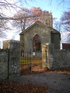 Portlick Church (Bunown)Church/chapel · 2.2 mi
Explorer Tom Portlick Church is standing there looking like it just heard a terrible joke about its own spires and hasn’t smiled…
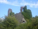 RindoonWood · 2.6 mi
Explorer Tom Rindoon in County Roscommon has a hidden message carved into its stones that says 'I told you so' but nobody has…
 Linear earthwork in WarrenLinear earthwork · 2.8 mi
Explorer Tom Linear earthwork in Warren is the hero nobody remembers who saved the castle from Phelim O Conchobair back in 1236.…
 Rindown CastleCastle, Anglo-Norman masonry castle · 2.8 mi
Explorer Tom Rindown Castle would write 'looking for adventure' on its dating profile. It's got a bay nearby, so the views are…
 Safe HarbourBay · 2.9 mi
Explorer Tom Safe Harbour would post on social media with a filter that makes it look calm, but we all know it’s actually having a…
 Catholic ChapelChurch · 2.9 mi
Explorer Tom Catholic Chapel in Warren is sitting right next to a promontory fort, which feels like living with a really aggressive…
 Historic town in Warren,rinnaganHistoric town · 3.1 mi
Explorer Tom Historic town in Warren has had more name changes than I've had bad haircuts this year. The O'Conor kings used its safe…
 Church in RinnaganChurch · 3.4 mi
Explorer Tom Church in Rinnagan had a bishop who refused to visit because the parking situation was 'suboptimal' for his chariot. He…
More historic places in County Westmeath · All of County Westmeath

What do you know about this place?Tap to add a comment or ask a question