
What is recorded here
From the Buildings of Ireland (National Inventory of Architectural Heritage) record 20403203
Places near here
Picture notes
- National Inventory of Architectural Heritage
- Computer-made picture. It does not show this playground.
- Computer-made picture. It does not show this monument.
- Computer-made picture. It does not show this mountain top.
- Willow, Wikimedia Commons · CC BY 2.5
- Eddylandzaat, Wikimedia Commons · CC BY 3.0
- Joseph Mischyshyn, Geograph · CC BY-SA 2.0
- Roger Diel, Geograph · CC BY-SA 2.0
- Bob Jones, Wikimedia Commons · CC BY-SA 2.0
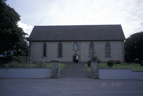 Catholic Church of Immaculate ConceptionChurch/chapel · 113 yd
Explorer Tom Inagh’s Immaculate Conception church, built in 1858, greets visitors with a statue over its door and leads the eye to a rear grotto.
 Children's playground150 ydTom: I’m here to help · Computer-made picture. It does not show this playground.
Explorer Tom A children's playground where the joy of playing is matched only by the beauty of the surroundings.
 Graveyard155 ydTom: I’m here to help · Computer-made picture. It does not show this monument.
Explorer Tom Graveyard in Carrowkeel West would tell its younger self to stop worrying about the weather and start enjoying the breeze. It’s a spot where time moves slower than your ability to find a signal on your phone. Ideal spot for a dramatic phone call that goes straight to voicemail.
 Children's burial ground in Sileshaun EastChildren's burial ground · 1303 ydTom: I’m here to help · Computer-made picture. It does not show this monument.
Explorer Tom Children's burial ground in Sileshaun East started because two lads bet on who could dig the deepest hole. It got out of hand fast, as usual with bets involving dirt. It's the kind of place that makes a dull Tuesday interesting and slightly weird for you.
 Earthwork in Ballyduff BegEarthwork · 1514 ydTom: I’m here to help · Computer-made picture. It does not show this monument.
Explorer Tom Let’s imagine an Earthwork in Ballyduff Beg as a humble mound that once held the keys to a forgotten local treasure chest.
 TurkenaghMountain / peak · 1.0 miTom: I’m here to help · Computer-made picture. It does not show this mountain top.
Explorer Tom Turkenagh, a peak that's as elusive as the paths leading to it in County Clare.
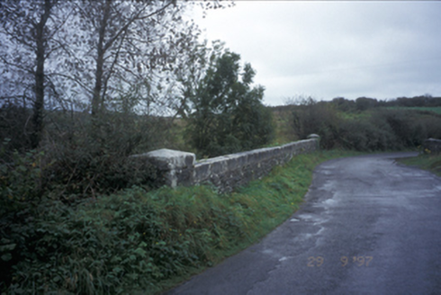 Friar's BridgeBridge · 2.1 mi
Explorer Tom Friar's Bridge is a sturdy single-arch structure from 1846, quietly connecting paths over the river in Formoyle Oughteragh.
 European ash2.2 mi
Explorer Tom Picture a sturdy European ash standing tall, its branches perhaps swaying gently above some quiet corner of the county.
 SlievecallanMountain / peak · 4.7 mi
Explorer Tom Slievecallan, a mountain that’s as rugged as the winter landscape it’s dressed in during January.
 Famine MemorialMemorial · 7.1 mi
Explorer Tom Famine Memorial stands as a solemn reminder of the past, honoring the victims of Ireland's great tragedy in County Clare.
 Moy Castle (in Ruins)Castle, unclassified · 7.2 mi
Explorer Tom Moy Castle in Moy Beg claims its name means 'Big Mud' but I think it just meant 'Oops'. Tell the next person you meet it's haunted. It might be.
 Dough CastleRuins · 8.6 mi
Explorer Tom Dough Castle is a former tower house situated on a rocky knoll above the River Inagh, close to O'Brien's Bridge.
More historic places in County Clare · All of County Clare

What do you know about this place?Tap to add a comment or ask a question