What is recorded here
Rectangular shaped house or hut site, measuring c4m N-S and c3m E-W with walls surviving up to 1m in height. It has been partially dug into the slope on the northern side to create a level interior. It is situated in an area of rocky outcrops and rough grazing to the west of a tributary of the Clashduff River and the Healy pass road. The stonework survives on the north and west sides while the rest consists of the overgrown lower courses.
Rectangular shaped house or hut site, measuring c4m N-S and c3m E-W with walls surviving up to 1m in height. It has been partially dug into the slope on the northern side to create a level interior. It is situated in an area of rocky outcrops and rough grazing to the west of a tributary of the Clashduff River and the Healy pass road. The stonework survives on the north and west sides while the rest consists of…
From the National Monuments Service (Archaeological Survey of Ireland) record CO103-033
The monument record does not grant public access. Check the route and ask the landowner before entering private land.
- What survives
- Recorded monument
Places near here
Photo credits
- Richard Webb, Geograph · CC BY-SA 2.0
- National Inventory of Architectural Heritage
- Jeff Buck, Geograph · CC BY-SA 2.0
- Mike Dickison, Wikimedia Commons · CC BY 4.0
- Yosemite, Wikimedia Commons · CC BY-SA 3.0
- Adriaen van Diest, Wikimedia Commons · Public domain
- Michael Dibb, Geograph · Creative Commons Attribution-ShareAlike 2.0
Enclosure in Clashduff (bear By.)Enclosure · 1371 yd Adrigole MountainMountain / peak · 1.2 miIllaunateeIslet · 1.7 miKnockowenMountain / peak · 1.8 miDuck RockIslet · 1.8 miAdrigole HouseRectory/glebe/vicarage/curate's house · 1.9 mihotel2.0 miMare's Tail WaterfallViewpoint · 2.1 miNew Zealand broadleaf3.8 miJapanese cedar3.8 miBattle of Bantry BayMajor battlefield · 4.9 miBurial GroundGraveyard · 5.2 mi
 Adrigole MountainMountain / peak · 1.2 miIllaunateeIslet · 1.7 mi
 KnockowenMountain / peak · 1.8 miDuck RockIslet · 1.8 mi
 Adrigole HouseRectory/glebe/vicarage/curate's house · 1.9 mi
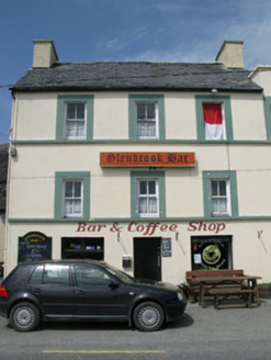 hotel2.0 mi
 Mare's Tail WaterfallViewpoint · 2.1 mi
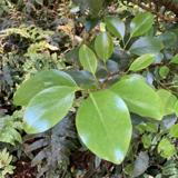 New Zealand broadleaf3.8 mi
 Japanese cedar3.8 mi
 Battle of Bantry BayMajor battlefield · 4.9 mi
 Burial GroundGraveyard · 5.2 mi
More archaeology and monuments in County Cork · All of County Cork
What do you know about this place?