What is recorded here
Places near here
Photo credits
- National Inventory of Architectural Heritage
- Jojo Nemčok, Wikimedia Commons · CC BY-SA 3.0
- Christine Matthews, Geograph · CC BY-SA 2.0
- William Murphy, Wikimedia Commons · CC BY-SA 2.0
- Rossyxan, Wikimedia Commons · CC BY-SA 4.0
- Christine Matthews, Geograph · Creative Commons Attribution-ShareAlike 2.0
- Sarah777 at English Wikipedia, Wikimedia Commons · Public domain
 Howth Black Linn LoopWalking route · 1 yd
Explorer Tom Howth Black Linn Loop in County Dublin is one of four loops from the station, which means you have choices. I pick the one with the best view. Which one are you doing?
Cannon RockNamed rock · 481 ydExplorer Tom Cannon Rock in County Dublin is just a rock with a name. It sits there looking important, probably because it was named after a cannon that fell off a ship long ago. Give it a wave from a safe distance.
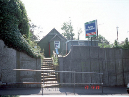 Bracken HallHall · 584 yd
Explorer Tom Bracken Hall in Howth is a corrugated-iron hall from 1930 that’s now disused. It has decorative timber barge boards and a pointed-arch door. I bet it rattles every time the wind blows past, like an old tin can rolling down a street.
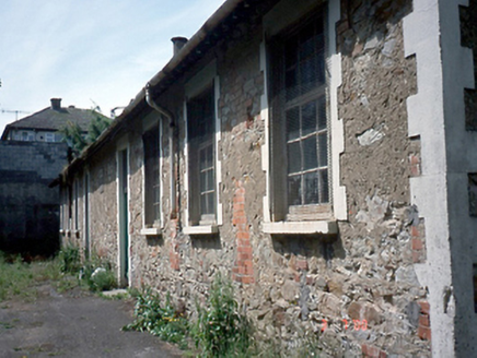 Howth National SchoolSchool · 613 yd
Explorer Tom Howth National School is empty and waiting for some ghost children to play hide-and-seek in its eight-bay stone walls. Built around 1900, it’s got a plaque and original windows that are definitely whispering old secrets. Don’t let it scare you!
Slí Fhine Gall - Binn Éadair - An MullachVisitor information · 872 ydExplorer Tom Slí Fhine Gall - Binn Éadair - An Mullach sounds like a tongue twister I invented. A hotel booking caption doesn't help much. Just get a photo of the signpost, yeah?
 Howth HeadCoastal headland · 894 yd
Explorer Tom Howth Head in County Dublin is a massive peninsula sticking out into the Irish Sea. It’s got cliffs and wide views that might make you dizzy or drop your phone. Take a pic of the edge for me!
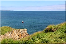 Cliffs of HowthViewpoint · 954 yd
Explorer Tom Cliffs of Howth are seen from the Balscadden Road, which sounds like a place built by people who hate walking. Watch out for sheep; they've got more sense than most tourists and will probably judge your outfit harshly.
 Martello Tower1021 yd
Explorer Tom Martello Tower in Howth. Stands on a natural spur above Balscadden Bay, with an entrance in the southwest side featuring a machicolation. A sturdy stone structure watching the sea, visible from the village below.
 Ben of HowthMountain / peak · 1031 yd
Explorer Tom Ben of Howth in County Dublin gives you a view of Portmarnock and Malahide from the northwest. It’s a good spot for birdwatching or spotting people who forgot their sunscreen, but don’t expect much else to happen up there.
 IndicatedGraveyard · 1053 yd
Explorer Tom Graveyard in Howth. After a 2011 storm collapsed part of this crenellated wall, the graveyard was buttressed to keep its secrets safely underground again.
 The Old CourthouseHeritage attraction · 1313 yd
Explorer Tom The Old Courthouse in Howth, County Dublin, has heard more secrets than a priest. The walls are probably listening right now. Take a picture for me if you pass! Whisper to the bricks.
 Shielmartin HillMountain / peak · 1.1 mi
Explorer Tom Shielmartin Hill gives a view towards Howth Head and Dollymount Strand. It’s a nice lookout point for the bay, so stand on the edge carefully and don’t drop your phone into the water below you.
More walking routes in County Dublin · All of County Dublin
What do you know about this place?Tap to add a comment or ask a question